Blog

  • CAGE Final Gathering February 2023

    CAGE Final Gathering February 2023

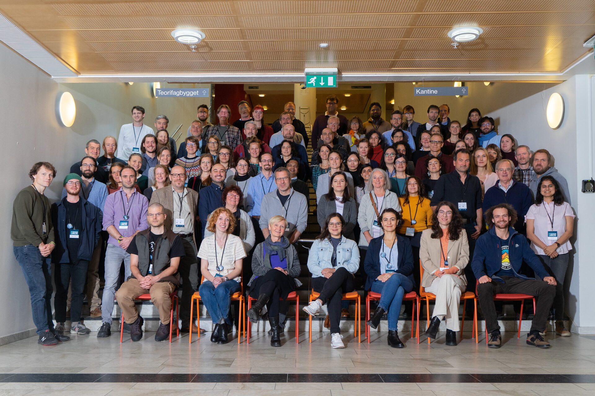
    Thank you to all of the CAGE and Department of Geosciences UiT  staff who joined us at Malangen Resort in February 2023 for the CAGE Final Gathering.

    This event was organized to mark the end of CAGE and to thank all those who have supported and contributed to the success of CAGE over this past decade.

    (more…)

  • February 28th 2023: Our final day as a Norwegian Centre of Excellence

    February 28th 2023: Our final day as a Norwegian Centre of Excellence

    February 28th 2023 was our official final day as a Centre of Excellence funded by The Norwegian Research Council.

    The Centre for Arctic Gas Hydrate, Environment and Climate (CAGE) was active between 2013-2023 and was hosted by the Department of Geosciences at UiT The Arctic University of Norway.

    It has been a very exciting decade with a lot of excellent science and discoveries, as we investigated the role of gas hydrates for the Arctic environment and climate. To ensure our legacy, the CAGE annual and cruise reports, along with our database, are openly available and can be accessed by all globally. You will find some information on how you can access these reports and the database by visiting the ‘Where are our reports archived?‘ and ‘Where is our data stored?‘ pages.

    We would like to finish by saying a big thank you to all of our staff, collaborators, and friends, for all of your hard work and dedication that has truly contributed to the success of CAGE.

    (more…)

  • Words from the CAGE Leadership

    Words from the CAGE Leadership

    After a successful mid-way evaluation of the first phase of CAGE (2013 – 2017), we took over the Centre leadership in August 2017. Our Scientific Advisory Committee states at our last joint meeting in February 2023 that “the Centre has established itself internationally as the leading research group on topics related to gas hydrate, climate, glaciations and the linkages between past, present and future methane dynamics and geosphere-hydrosphere-atmosphere interactions”

    Text by Professor Karin Andreassen (Director of CAGE), Associate Professor Monica Winsborrow and Dr. Jochen Knies (co-assistant directors)


    Methane in the Arctic

    Vast amounts of methane, a greenhouse gas far stronger than CO2 are trapped at shallow depths below the seafloor as gas hydrates, ice-like mixtures of gas and water. Current ocean warming makes these shallow methane reservoirs particularly vulnerable to thawing. CAGE has investigated the processes involved and implications for the Arctic climate and environment.


    Scientific Excellence

    CAGE has integrated transdisciplinary research on methane reservoirs beneath the seafloor, conditions at the sea floor, in the water column and in the atmosphere. We have focused on enhanced understanding of the past and present, and developed models to predict future trajectories.

    In numbers, our scientific staff and students have during the decade of CAGE produced 465 peer-reviewed scientific publications (62 of these in Nature and Science journals) and 33 book contributions, with contributions from 3502 scientists from over 45 different countries. The Centre has now an H-index of 50 and over 9230 citations. The success of our research builds on integrating state-of-the art empirical data with numerical modelling, and scientific collaborations with academic and industry partners.


    Some Highlights

    Our location at the doorstep of the Barents Sea and access to the ice-going research vessels Helmer Hanssen and Kronprins Haakon have clearly been a strong advantage. CAGE has since its conception in 2013 led 69 scientific cruises with a cumulative ~2.5 years at sea, and we have continuously strived to use state-of-the-art technologies in data acquisition such as remotely operated vehicles, seabed- ocean-observatory networks, high-resolution 4D seismic surveys, drones and satellite images.

    We have developed procedures to detect the amount of carbon stored in reservoirs of gas hydrate and free gas under the seafloor, the leakage from these carbon systems, their faith in water column and to monitor variations in gas flow with tidal and seasonal cycles and currents.

    We have developed a toolbox to identify, understand, and date past methane leakage events, and we have highlighted the role of ice sheets in generating hotspots for exceptionally abundant natural seepages of gas and oil across Arctic continental shelves.


    Looking ahead

    Although CAGE is history from 1st March 2023, large parts of CAGE infrastructure and research will continue and be further developed within the new Centre of Excellence, “Centre for ice, Cryosphere, Carbon and Climate – iC3”, which was recently awarded by the Research Council of Norway (RCN) to the Department of Geoscience (IG), UiT for 2023 – 2033. iC3 is led by the two CAGE scientists Jemma Wadham and Monica Winsborrow. In addition, several other research projects initiated by researchers of the Centre will continue within Department of Geoscience, UiT.

    CAGE has educated 28 PhDs (14 Male/14 Female), and 69 Master students. Several young CAGE researchers have established their own research groups, with funding from The European Research Council (ERC), The Research Council of Norway (RCN) and Tromsø Research Foundation; two in Norway, two in France, and one in Sweden.

    Efforts of CAGE scientists towards future scientific ocean drilling in the circum-Arctic succeed­ed in 2022. The last IODP science and security panels for our planned scientific drilling expeditions east of Green­land and northwest Svalbard were finally passed, and the planned Expedition #403 is now sched­uled for summer 2024.

    It has been a privilege to work within CAGE, it has been an amazing journey and a lot to learn. However, our scientific results would not have been possible without the generous funding from RCN and the support from UiT, the Faculty of Science and Technology and the Department of geosciences. We have further been blessed by having access to two fantastic ice-going research vessels, RV Helmer Hanssen and RV Kronprins Haakon. Finally, our largest resource has been the people working within CAGE; our PhD- and Master students, Postdoctoral fellows, Researchers, Professors, and the technical and administrative staff that have supported us. Thank you so much to you all!


    Karin Andreassen                            Monica Winsborrow                       Jochen Knies

  • Where can you find our reports?

    Where can you find our reports?

    CAGE Report Series on Septentrio Academic Publishing

    The CAGE – Centre for Arctic Gas Hydrate, Environment and Climate Report Series is a collection of reports and the main results from 2013 to 2023, including annual reports, cruise reports, scientific publications, theses, CAGE website blogs, and science communication. These reports are archived on Septentrio Academic Publishing  – a service for open access publishing provided and owned by the UiT library.


    (more…)

  • Where is our data stored?

    Where is our data stored?

    Database

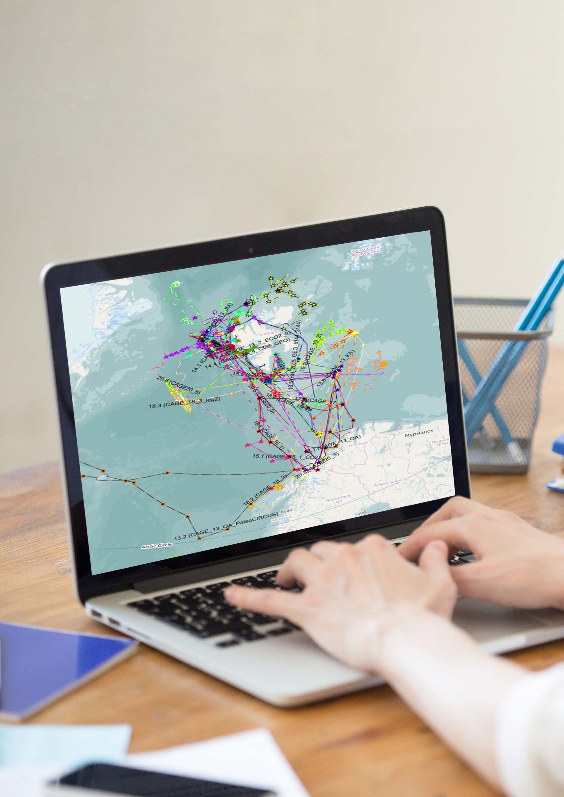
    Our geospatial database map, accessible through the CAGE Report Series Database page, provides an overview of the CAGE cruises and the associated reports and data that has been collected during each cruise.

    The CAGE Report Series Database page is designed to prepare the users to access and navigate through the geospatial database map. It provides various information, such as a link to the map, instructions for operating and downloading the database metadata, and useful contacts, should the user require additional assistance or access to the data.


  • The incredible power of the ice that sculpted Europe’s landscape

    The incredible power of the ice that sculpted Europe’s landscape

    New research from CAGE/UiT in Nature Communications show that the immense ice sheet that covered Europe during the last ice age excavated the bedrock equivalent of more than 500 Mt Everests. This extreme glacial erosion profoundly sculpted the landscape we live, work and play in, with incredible impacts on the mountains, lakes, rivers, coasts, soils, mineral and carbon deposits. It even realized many of the geohazards latent across Scandinavia and Europe today.

    Text: Mariana Esteves

    During the last ice age, the Eurasian Ice Sheet was immense – the third largest on Earth spanning over 5,500 km from temperate conditions in southern Britain to the frigid polar regions of Svalbard and Siberia. Until now, the influence of this ice on Europe’s landscape has not been fully realized, but a new study led by Dr Henry Patton and published in Nature Communications, brings a brand-new perspective on the erosive impact of this great ice sheet that covered Northwest Europe and parts of Asia during the last glacial.

    “This study applies a transient model constrained by real-world observations to reconstruct the evolving erosional signature of the Eurasian Ice Sheet through the last 100,000 year-long ice age, revealing how it profoundly sculpted but also protected the landscape visible today.” Says Dr Henry Patton, who conducted this research at CAGE/UiT.

    The erosional footprint of the Eurasian Ice Sheet

    Using multiple strands of geophysical evidence to train a new model of the Eurasian Ice Sheet, Dr Patton and co-authors reveal the extreme and complex nature of glacial erosion over the last 100,000 years, providing an invaluable long-term perspective. The efficiency and interplay of environmental and internal controls governing the patterns of erosion are identified: the key roles of climate, geology and topography, but also the critical importance of the ice sheet’s thermal and mechanical regime itself.

    Mean glacial erosion rates modelled beneath the last Eurasian Ice Sheet during the last ice age, with the Trough Mouth Fan (TMF) sediment deposits that were used to constrain these results highlighted. Find out more in Figure 3, Patton et al., 2022.

    The Eurasian Ice Sheet was almost 3,000 m thick in places and thus had a pronounced impact on the landscape through its erosional footprint. Yet, results from this study show that while there has been focused extreme erosion in some areas like the glacial fjords of Western Norway and in the Barents Sea, there were also large swathes of the landscape – like the high elevation plateaus of Sweden and Norway – that the ice hardly affected at all.

    Erosion rates impacted by the climate

    Much like in Greenland and Antarctica today, the study finds a close link between climate and ice sheet erosion. It shows that a series of rapid ice sheet fluctuations where rates of erosion increased by almost 1 cm per year occurred on incredibly short, decadal, timescales. These brief “bursts of intense erosion” occurred during periods of abrupt warming, such as around 15,000 years ago at the end of the last ice age – when rising temperatures destabilised remaining ice cover over Eurasia.

    The rapidly melting ice during these phases vastly increased the meltwater reaching the bed of the ice sheet, forming vast networks of subglacial rivers and promoting faster ice flow that worked to excavate the bedrock and sediments. These meltwater rivers also transported these eroded sediments from beneath the ice sheet and into the adjoining oceans and fjords, creating an ideal environment for algal blooms to flourish and becoming a major marine carbon sink.

    “At its peak melting, the Eurasian ice sheet was discharging sediment volumes equivalent to that found in all rivers globally today. These new modelling results really illustrate not only how ice sheets can respond rapidly to environmental changes over decadal to centennial timescales, but also the huge knock-on effects for many other Earth systems beyond the ice sheet margins.” Says Patton.

    The study and results are also relevant to what is going on in Greenland today. Professor Alun Hubbard, co-author of the study says:

    “Over the last two decades, Greenland has been losing its vast terrestrial ice reservoir – sufficient to raise global sea-levels by over 7 metres – even faster than the great ice sheets retreated at the end of the last ice age.  Greenland’s current deglaciation and locked in commitment to sea-level is the single largest threat to the billion people who live in vulnerable, low-lying regions of the planet. We must act now to curtail carbon emissions and rising temperatures.”

    But every cloud has a silver-lining. The quantities of sediments and nutrients washed out by Greenland’s meltwater in plumes, is also sustaining incredible levels of marine-productivity – a boon for the local fishing industry, who are now experiencing record export levels to international markets.

    Melt lake on the Greenland Ice Sheet. Photo: Alun Hubbard.
    Areas with increased erosion pose a geohazard problem

    The impressive glacial imprint in the landscape, for example along Norwegians coasts, has been sculpted over many ice-age cycles, with deep fjords and submarine troughs carved by repeated ice sheet advances. However, a legacy of this intense erosion and deep freezing of mountain landscapes are the inherently over steepened and unstable slopes left behind after deglaciation. Failure of these mountain slopes poses a significant geohazard to many communities across formerly glaciated landscapes around the globe, particularly now as temperatures rise and the permafrost and ice binding these cliffs together thaws.

     “By untangling the erosional signature of these past ice sheets we are moving a step closer in being able to understand the long-term processes that affect the landscapes around us today. One important aspect is on the stability of these eroded mountain slopes, which for many around the world still pose a real threat even thousands of years after the last glaciers melted away.” Says Patton.

    Intense glacial erosion over the last ice age has shaped the landscapes we see today, such as here in the Geirangerfjord, Norway. Photo: Mariana Esteves


    Read more: Patton, H., Hubbard, A., Heyman, J. et al. The extreme yet transient nature of glacial erosion. Nat Communications 13, 7377 (2022). https://doi.org/10.1038/s41467-022-35072-0

  • Muhammed Fatih Sert will defend thesis on “Biogeochemistry of dissolved organic matter in Arctic Ocean waters charged with methane”

    Muhammed Fatih Sert will defend thesis on “Biogeochemistry of dissolved organic matter in Arctic Ocean waters charged with methane”

    Muhammed Fatih Sert will publicly defend his PhD thesis entitled, “Biogeochemistry of dissolved organic matter in Arctic Ocean waters charged with methane” on November 25th 2022 at UiT – The Arctic University of Norway. This work was funded by the Centre for Arctic Gas Hydrate, Environment, and Climate (CAGE) at UiT.

    The trial lecture and public defense will take place at Naturfagbygget and it will also be streamed online.

    Trial lecture

    Public defense


    Popular scientific abstract

    Dissolved organic matter (DOM) is defined as organic matter that is smaller than a nominal pore size filter (e.g., 0.7 µm) that passes through during the filtration of aquatic samples. It comprises the largest reservoir of reduced carbon (700 Pg C) in the oceans. The DOM pool is in close interaction with all the elemental cycles and food chains in the ocean and is an essential component in the marine microbial loop. Methane is seeping from numerous geological sources in the Arctic Ocean associated with multiple mechanisms that elevate methane production and release. Independent of the mechanism, however, liberated methane is predominantly consumed in the water column by methanotrophic bacteria (MOB), which use methane as a source of carbon and energy during an aerobic enzymatic reaction called methane oxidation (MOx). In sedimentary fluid flow systems such as cold seeps or hydrothermal vents, the amount of methane release and subsequent MOx would be substantial and further trigger other ecosystem processes such as bacterial growth and heterotrophic consumption and consequent mechanisms that alter DOM composition in the water column. Since methane is one of the most potent greenhouse gasses in the atmosphere and due to its subsequent effect on global warming, it has been quantified extensively in the oceanic environments and its fate in the water column has been investigated in different types of geological settings. However, the effects of methane emanation and methane-driven processes on DOM dynamics in the water column have been merely constrained. The main objective of this thesis was to unravel the modifications of DOM composition in relation to methane release in the Arctic Ocean cold seeps and hydrothermal vents.


    The plan for Muhammed Fatih Sert’s public defense for the PhD degree in Science, on November 25th 2022, is as follows:

    Trial lecture at 10:15 on the following topic:

     ‘The fate of anthropogenic CO2 in the ocean’

    PhD thesis defense at 12:15:

    ‘Biogeochemistry of dissolved organic matter in Arctic Ocean waters charged with methane’


    PhD Thesis is published and available here.


    Supervisors:

    • Researcher Dr. Anna Silyakova, Department of Geosciences, UiT (main supervisor)
    • Researcher Dr. Friederike Gründger, Department of Biology, Aarhus University, Denmark
    • Professor Helge Niemann, NIOZ Royal Institute for Sea Research, the Netherlands

    Evaluation Committee:

    • Professor Thorsten Dittmar, ICBM, Universität Oldenburg, Germany (1. opponent)
    • Dr Jeffrey Hawkes, Department of Chemistry, University of Uppsala, Sweden (2. Opponent)
    • Professor Giuliana Panieri, Department of Geosciences, UiT (internal member and leader of the
      committee)

    To read more about the findings of this research:

    Sert, M.F., D’Andrilli, J., Gründger, F., Niemann, H., Granskog, M.A., Pavlov, A.K., Ferré, B. & Silyakova, A. (2020). Compositional Differences in Dissolved Organic Matter Between Arctic Cold Seeps Versus Non-Seep Sites at the Svalbard Continental Margin and the Barents Sea. Frontiers in Earth Sciences, 8, 552731. Also available in Munin at https://hdl.handle.net/10037/20176. https://doi.org/10.3389/feart.2020.552731

    Sert, M.F., Niemann, H., Reeves, E.P., Granskog, M.A., Hand, K.P., Kekäläinen, T., … Gründger, F. (2022). Composition of dissolved organic matter in the ice-covered water column above hydrothermal vents at the Aurora Seamount, Gakkel Ridge, Arctic Ocean. Biogeosciences, 19, 2101–2120. Also available in Munin at https://hdl.handle.net/10037/24913. https://doi.org/10.5194/bg-19-2101-2022

  • Methane leaks in the Arctic – How do they affect the climate and environment?

    Methane leaks in the Arctic – How do they affect the climate and environment?

    As CAGE approaches the end of its tenure, we would like to share some highlights of our success and inform about where you can access the data and reports from our research. As part of this initiative to ensure a CAGE legacy, the CAGE director, our scientists, and the communication and database coordinators have written feature articles for the popular science magazine, “Ottar”.

    Led by Norway’s Arctic University Museum, the popular science magazine “Ottar” is written in Norwegian and aimed at people of all ages and can be found in school and public libraries for all to enjoy. It is available for free online, and paper copies can be bought from Tromsø Museum.

    The Ottar magazine includes the following CAGE contributions:

    • Innledning (Introduction) by CAGE Director, Professor Karin Andreassen
    • Hvor kommer metanlekkasjene fra? (Where do methane leaks come from?) by Professor Stefan Bünz, Associate Professor Andreia Plaza-Faverola, Dr Sunil Vadakkepuliyambatta and Dr Malin Waage
    • Istidenes betydning (The importance of ice ages) by Associate Professor Monica Winsborrow, Professor Karin Andreassen, Dr Henry Patton and Dr Pavel Serov
    • Økosystem som filter for metanlekkasjer (Ecosystem as a filter for methane leaks) by Associate Professor Arunima Sen, Dr Vincent Carrier and Professor Mette M. Svenning
    • Overvåking av metan i vannet (Monitoring of methane in the water) by Dr Benedicte Ferré, Dr Knut Ola Dølven and PhD candidate Muhammed Fatih Sert
    • Da Barentshavet lekket som en sil (When the Barents Sea leaked like a sieve) by Dr Jochen Knies, Dr Aivo Lepland, Dr Shyam Chand and Dr Gudmund Løvø
    • Små, men fulle av gode historier: hva kan kalkskjellene til små havdyr fortelle oss om moderne klimaendringer og metanlekkasjer? (Small but full of good stories: what can the calcareous shells of small marine animals tell us about modern climate change and methane leaks) by Dr Naima El bani Altuna, PhD candidate Griselda Anglada-Ortiz, Dr Kasia Melaniuk, Dr Siri Ofstad, Dr Mohamed M. Ezat, Dr Kamila Sztybor, PhD candidate Christine Lockwood-Ireland and Professor Tine L. Rasmussen
    • Formidling av forskning i CAGE (Dissemination of research in CAGE) by Dr Mariana Esteves and Professor Karin Andreassen
    • CAGE Database, fra intern ressurs til offentlig arv (CAGE Database, from internal resource to public heritage) by Fabio Sarti and Professor Karin Andreassen


    Read the latest Ottar magazine (Norwegian only), here.
    Read more about Ottar (in Norwegian), here.
  • Methane emissions in the Arctic diversify the diets of marine ecosystems living in productive shallow-marine areas

    Methane emissions in the Arctic diversify the diets of marine ecosystems living in productive shallow-marine areas

    It is well established that deep-sea ecosystems living in natural cold seep sites around the world thrive in areas where their only food source is limited to the uptake of carbon through chemosynthesis. However, it wasn’t until now that we discovered how these natural methane seep sites influenced the diet of Arctic ecosystems in shallow-marine areas, such as the Barents Sea.

    Text: Mariana Esteves

    Published in Frontiers in Marine Science, the findings from the recent study, led by Dr Emmelie Åström (former CAGE PhD, UiT/Nansen Legacy), brings new knowledge and understanding of the communities thriving in cold seeps located at shallow Arctic shelves.

    Food is crucial for the success of all ecosystems, with communities adapting their diet according to the type of food that is available. For some deep-sea ecosystems, communities depend on the release of chemical compounds that can be found at cold seep sites. Here, organisms are largely reliant on using chemosynthesis to uptake the carbon (for example, methane) coming from the gas emissions as an alternative food source to the use of photosynthesis, since light cannot reach the deep-ocean.

    (more…)

  • CAGE scientists will lead the newly funded Norwegian Centre of Excellence for Outstanding Research at UiT: Centre for ice, Cryosphere, Carbon and Climate (iC3)

    CAGE scientists will lead the newly funded Norwegian Centre of Excellence for Outstanding Research at UiT: Centre for ice, Cryosphere, Carbon and Climate (iC3)

    Global climate is rapidly warming, impacting Polar Regions, and causing ice sheets to melt and thin at unprecedented rates. Massive stores of carbon are held beneath these ice sheets, alongside vulnerable ecosystems and large carbon sinks associated with the aligned polar oceans. The impact of ice sheet retreat on Earth’s carbon cycle has high uncertainty and is not currently included in the UN’s Intergovernmental Panel on Climate Change assessments.
    Bringing together world-leading experts, the new Centre of Excellence, Centre for ice, Cryosphere, Carbon and Climate (iC3) will fill a vital knowledge gap in polar science by quantifying impacts of ice sheet change on Earth’s carbon cycle and sensitive ocean ecosystems.

    Text: Mariana Esteves

    Following tough competition, the Research Council of Norway announced on the 23rd September that nine new Centres of Excellence (SFF) had received generous funding over a 10-year period to undertake ground-breaking research. We are proud that one of the successful centres was the Centre for ice, Cryosphere, Carbon and Climate (iC3), led by CAGE scientists, Professor Jemma Wadham and Associate Professor Monica Winsborrow (CAGE assistant director and WP2 team leader). The opportunity to apply for a new SFF is announced every five years and is highly sought-after with only a 5-10% success rate. CAGE was awarded this same status in 2013, making iC3 the second SFF hosted by the Department of Geosciences, UiT.

    Focused on the role ice sheets play in the global carbon budget, iC3 builds in part on CAGE expertise. Ice sheets represent one of the most biologically-active carbon stores on Earth, overlying ancient soils, lake/marine sediments, and deep hydrocarbon reservoirs, and are directly linked to carbon cycling in downstream marine ecosystems via meltwater discharge and associated carbon and nutrients. Yet, there are order of magnitude uncertainties in carbon stores and fluxes, and currently ice sheets are rarely included in global carbon budgets. Reducing this uncertainty is vital to inform policy and management strategies in polar regions and globally.

    Tackling this grand challenge requires expertise from many different scientific disciplines including  glaciology, geology, microbiology, geochemistry and oceanography; and iC3 will unite world-leading experts from CAGE, UiT, Norwegian Polar Institute, NORCE and other institutions around the world.

    iC3 will also benefit from world-leading Norwegian infrastructure such as research facilities and polar research vessels, that will enable investigation of carbon-cryosphere interactions across the entire ice-to-ocean domain, in both the Arctic and Antarctic.


    Press release from UiT The Arctic University of Norway:

    https://en.uit.no/news/article?p_document_id=790088

    Announcements from the Norwegian Research Council, Forskningsrådet (in Norwegian):

    https://www.forskningsradet.no/sok-om-finansiering/midler-fra-forskningsradet/sff/soknadsresultater-sff-v/

    https://www.forskningsradet.no/nyheter/2022/14-milliarder-kroner-til-ni-nye-sentre-for-fremragende-forskning/

  • Methane in a changing Arctic: the final international CAGE conference

    Methane in a changing Arctic: the final international CAGE conference

    For nearly 10 years, CAGE has been an active contributor to the global conversation on the role of methane in a changing Arctic and related environmental issues. CAGE’s main goal is to quantify methane release beneath the Arctic Ocean, and to assess its potential impact on marine environments and global climate in the past, present and future. As CAGE entered its last months of a Norwegian Centre of Excellence, we invited scientists from all around the world to join us for the final international conference that CAGE would host, on ‘Methane in a Changing Arctic’.

    Text: Mariana Esteves

    Held between 14-16th September at UiT the Arctic University of Norway, the conference brought together more than 140 scientists, from 14 different countries, to discuss all aspects of Arctic methane and its role in the global carbon cycle. Our goal was to provide interdisciplinary forum for discussion and exchange of knowledge relating to our current understanding of these complex systems and their response to and impact on, the rapid environmental and climatic changes that characterise the Arctic.

    In total we had eight sessions, with over 90 presentations (both oral and poster):

    1. Methane in the geosphere: subsurface thermogenic, (a-)biogenic and methane stores and sinks
    2. Methane in the hydrosphere: methane processes and budgets in marine and lacustrine settings
    3. Methane in the cryosphere: methane dynamics in ice sheets and permafrost
    4. Methane in the atmosphere: methane source, sinks, and budget in the atmosphere
    5. Microbial cycling of methane: the role of microbes in methane budgets
    6. Past methane histories: past methane processes and budgets as analogues for future climate scenarios
    7. Science and Art
    8. Outreach and Education

    We would like to thank all who participated and attended the CAGE International Conference on Methane in a Changing Arctic. This conference was a success, promoting important discussions regarding Arctic methane and the global carbon budget.

    Conference participants. Photo: Kai Mortensen/UiT


    The organising committee and Master student volunteers. Left to right – Péter Paloczy (Master student), Zeynep Sancak Sert (CAGE Administrative advisor; Co-lead organiser), Freya Sykes (PhD Candidate), Karin Andreassen (Director of CAGE), Marie Stetzler (PhD Candidate), Luke Simmons (Master student), Mariana Esteves (Lead organiser; Project leader for CAGE), and Isaiah Olayiwola (Master student). Photo: Kai Mortensen/UiT


    To read more about the conference: https://site.uit.no/methane-in-a-changing-arctic/ 
    More photographs from the conference on the CAGE Instagram: https://www.instagram.com/cage.coe/


  • What’s lurking on top of the below

    What’s lurking on top of the below

    Greetings from onboard the R/V Helmer Hanssen, where we are exploring the Barents Sea in the region south of Svalbard. The quest for mapping territory has driven explorers and scientists for centuries, and for us on this cruise it is no different. Our domain of exploration extends south and southeast of Svalbard, in the regions called Spitsbergenbanken, Hopendjupet, Nordflaket, and Bjørnøyrenna. The objectives of this 18-day expedition, “CAGE-22-6-HH”, are manifold but the main aim is to map and study sites of fluid flow on the seafloor, which can be related to natural methane and gas seeps, and link to their geological setting.

    Sunday 14th August 2022

    Text: Grace Shepard

    Figure 1: Overview of the bathymetry of the Barents Sea and cruise-track thus far. We departed Longyearbyen on August 2nd 2022 and expect to arrive in Tromsø on August 20th.

    It is also an educational cruise, both as a UiT and UiO field course (GEO-x144) and a UNESCO Teaching-Through-Research course (TTR-22). There is therefore a heavy hands-on and two-way educational component between the students and senior scientists onboard.

    We are a scientific party of 13 people, plus two instrument engineers, and the ship’s crew. We are 10 nationalities – Australia, Brazil, Britain, Columbia, Denmark, Italy, Germany, Norway, Russia – and from four universities (UiT, UiO, Bologna and Kiel). Onboard, there are experts on seismology, glaciology, marine geology and geophysics, oil and gas processes, paleontology, mud volcanos, oceanography, plate tectonics, numerical modelling, seismic hazards, gas hydrates, methane emissions, and more, so there is plenty of science to be exchanged.

    Figure 2: PhD candidate Juan Camilo Meza Cala in the instrument room looking for gas flares. The bottom triangular window on his screen even shows a flare (yellow feature in the middle dipping to the bottom right).

    Three of us onboard are from a “sister” Centre of Excellence in Norway – The Centre for Earth Evolution of Dynamics (CEED) at the University of Oslo – which was established in the same funding round as CAGE (2013-2023). Our centres have already collaborated a few times before for expeditions, research and education, and it is a pleasure to combine forces once more whilst both centres still exist!

    On a regular work day, I study the past configuration of landmasses and oceans – also known as plate tectonics. I have a particular interest in the formation of the Arctic and North Atlantic, as well and the processes occurring in the deep interior of the Earth (down to 2900 km below our feet). To do this, I typically look at timescales of tens or hundreds of millions of years in the past, so a switch to more “recent” glacial and Holocene sedimentation timescales is a welcome change. I just have to drop a few zeros from the 100,000,000 years, and we’re in business!

    Figure 3: Some of the newly mapped features on the seafloor. Including a) annual sedimentary deposits from past glacial channels, b) “hill-hole” pairs possibly formed when sediment blocks freeze onto the base of the ice sheet before being dumped downstream, and c) some of the many iceberg scours that wiggle in all directions. These images are made from the multibeam data as the ship passes overhead and are loaded into the software, Fledermaus.

    It follows that when I think of “seafloor” processes, I usually strip away the topmost sedimentary cover to look at the rock layers below, but on this particular cruise I have discovered for myself an exciting world of features on the very top of the bottom.

    The ship’s multi-beam instrument maps out the depth to the seafloor (bathymetry), which in turn reveals many bumps and holes of different sizes and shapes. Many of the (presumably) glacial features are probably very familiar to the long-term readership of this blog, but they are quite new to me. It is quite fun to see them being mapped out for the first time at this resolution, and in real-time too. It is also a reminder about the constant state of change occurring across our planet at all sorts of time-scales, no matter the number of zeros!

    Figure 4: A zoomed-in and 3-D perspective (vertical exaggeration) of the multi-beam seafloor data as shown in plot c of Figure 3. A profile running across the path reveals some of the highs and lows.


    Dr. Grace E. Shephard
    grace.shephard@geo.uio.no
    Researcher
    Centre for Earth Evolution and Dynamics (CEED)
    University of Oslo
    Twitter: @CEEDOslo @PolarisArctic @ShepGracie
    Insta: @ceedoslo @polarisdigitalarctic
  • Stressed seeps under pressure

    Stressed seeps under pressure

    Text: Bénédicte Ferré

    One of our operations was to deploy two piezometers in order to monitor the pore pressure within the sediment near the seeps, an operation lead by Thibaut Barreyre at UiB. We used a huge 4-tons rig to deploy this thin 3-m long equipment. The operation requires the ROV to detach the weights from the rig that releases the piezometer onto the sediment, and once the rig is lifted back up from the ship, the ROV installs the datalogger that will keep collecting data for 511 days. The data will then be analyzed and used to unravel the subseafloor permeability, to ultimately constrain how much methane is released from the seabed to the overlying ocean.

    And sometimes sciences means improvising, here is how we clean dirty piezometers at a 250m deep site… and it worked!

    Rig used to deploy the piezometers.

    The ROV releases the weights so the standpipe penetrates the sediment.

    The ROV has installed the datalogger on the standpipe.

    This is not rocket science, but it does the job.

  • Cohabitation of methane seeps and coral reef

    Cohabitation of methane seeps and coral reef

    Text: Bénédicte Ferré

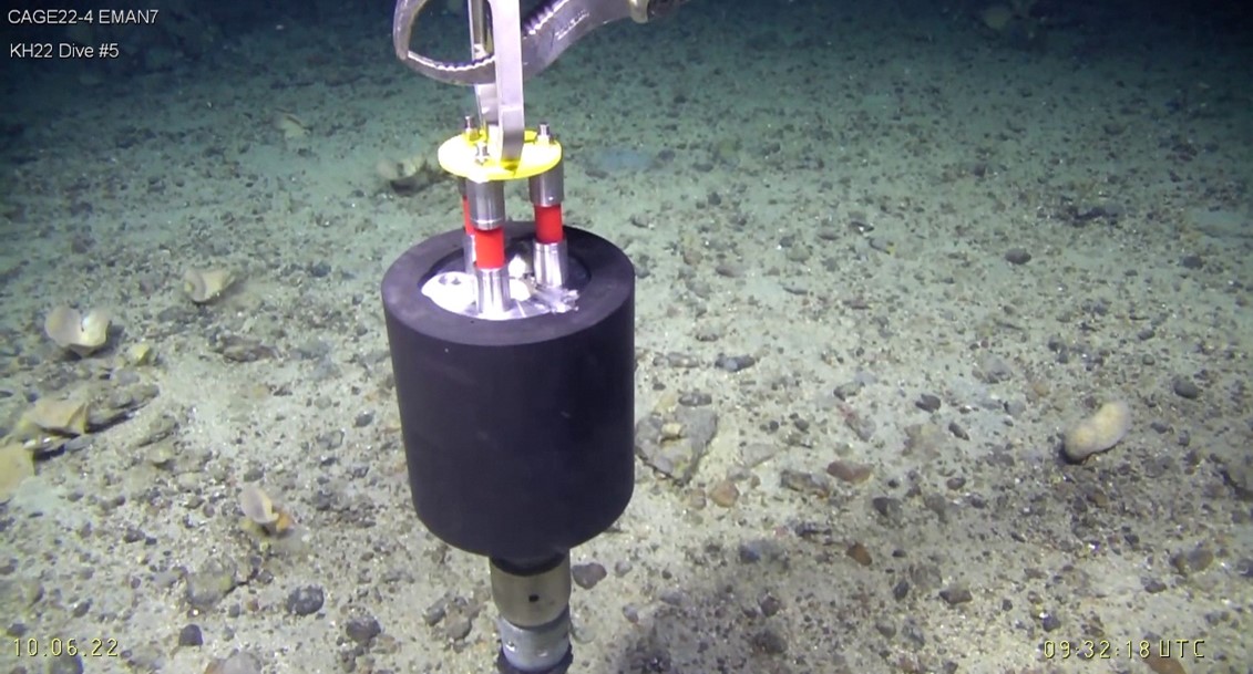
    The project EMAN7 (Environmental impact of Methane seepage and sub-seabed characterization at LoVe – Node 7) consists in a consortium between UiT, UiB and IMR. Our main mission is to understand how oceanic parameters and climate change influence methane seepage from the seafloor, and the subsequent impacts on ecosystem health. Node 7, one of the 7 nodes installed in the frame of the project Lofoten-Vesterålen Ocean Observatory (LoVe), is deployed in a seepage area. Only 180m north of these seeps lives a large and healthy cold water coral reef. Why are these coral reefs thriving there despite a possible ocean acidification due to methane emission? What is influencing this release and how does it influence the surrounding sub-seafloor and water column? How long has the methane been leaking there? Where does it go? How much carbon is expelled from the seafloor? We are trying to answer these questions using the long time series collected from the node, and also from data collected during our current cruise.

    We are used to chasing flares during our cruises at CAGE, but this time we also look for corals. These beautiful submarine flowers cover part of the floor at Hola trough, and one of the teams, led by Tina Kutti from IMR, collects them to understand the effect of CH4 seeps on cold water coral reef communities and their capacity for adaptation. Answering this is impossible in lab environment because these are extremely long -lived species that require decades of exposure to reveal their true stress response.

    Cold water coral reef near node 7 in Hola trough.

  • CAGE Invites Conference on the Changing Arctic: Ocean, Ice, and Climate

    CAGE Invites Conference on the Changing Arctic: Ocean, Ice, and Climate

    We would like to say a big thank you to everyone who participated and to those who presented their research for the stimulating and important talks and posters during the CAGE Invites Conference on the Changing Arctic: Ocean, Ice, and Climate, last Tuesday, 31st May 2022.

    To understand the changes occurring in the Arctic we require collaborative, transdisciplinary action. For this reason, CAGE which is now in its final year, invited numerous Tromsø scientists from the Arctic research community to provide a platform for discussions and the formation of potential synergies between the different Tromsø research institutes and centres. By bringing together the Tromsø Arctic research community to raise awareness of the changing Arctic through a variety of perspectives, we were able to get an overview of the key physical changes, societal implications, and mitigation efforts.

    Below are some photos from the day taken by Kai Mortensen (IG, UiT).

    The day started with a welcome speech by Prof. Camilla Brekke – Pro-Rector for Research and Development, UiT. Photo credit: Kai Mortensen.


    Prof. Karin Andreassen (Director of CAGE) presented ‘Arctic Methane Seepage, gas hydrates, environment and climate’. Photo credit: Kai Mortensen.


    Dr. Sebastian Gerland (leader of Ocean and Sea Ice section at the Norwegian Polar Institute and Co-PI of the Nansen Legacy Project) presented the ‘Changing State of the Climate System, with focus on the Cryosphere: Examples from Chapter 2 of the recent IPCC Sixth Assessment Report Working group 1 (The Physical Science Basis)’. Photo credit: Kai Mortensen.


    The conference was hybrid, with almost 90 people joining us both in-person and digitally. Photo credit: Kai Mortensen.


    Photo credit: Kai Mortensen.


    Photo credit: Kai Mortensen.
    Photo credit: Kai Mortensen.
    Photo credit: Kai Mortensen.
    Prof. Marit Reigstad (PI for the Nansen Legacy Project) presented ‘The Nansen Legacy – new insights to a changing Barents Sea’. Photo credit: Kai Mortensen.
    Dr. Matthias Forwick (Leader of the Department of Geosciences, UiT) presented ‘Environmental changes in the Arctic beyond instrumental records’. Photo credit: Kai Mortensen.
    Prof. Torbjørn Eltoft (Director of CIRFA – Centre for integrated remote sensing and forecasting for Arctic Operations) presented ‘Satellite-based Sea ice monitoring in a climate perspective’. Photo credit: Kai Mortensen.
    Dr. Tore Hattermann (Researcher at the Norwegian Polar Institute and holds an adjunct associate professorship at UiT) presented ‘Modelling the Arctic Ocean – Overview, Challenges and Perspectives’. Photo credit: Kai Mortensen.
    Dr. Hans Christopher Bernstein is an Associate professor at ARC (Arctic Centre for Sustainable Energy)/Faculty of Biosciences, Fisheries and Economics, UiT The Arctic University of Norway, presented ‘Arctic algae and their microbiomes: from ecology to biotechnology’. Photo credit: Kai Mortensen.
    Dr. Maaike Knol-Kauffman, Researcher at the Faculty of Biosciences, Fisheries and Economics, UiT The Arctic University of Norway, presented ‘Activity trends and changing information infrastructures in the marine Arctic’. Photo credit: Kai Mortensen.
    Prof. Ingvild Ulrikke Jakobsen, Director of the Norwegian Centre for Law of the Sea, presented ‘Developing good governance of the changing Arctic by implementing ecosystem approach in Norway’. Photo credit: Kai Mortensen.


    The organising committee for the CAGE Invites Conference. L-R: Prof. Karin Andreassen, Zeynep Sancak Sert, Marie Stetzler, Frances Cooke, Dr. Mariana Esteves. All keynote speakers and members of the organising committee received a copy of Prof Jemma Wadham book ‘Ice Rivers‘. Photo credit: Kai Mortensen.
    Photo credit: Kai Mortensen.


    Photo credit: Kai Mortensen.


    Photo credit: Kai Mortensen.


    Photo credit: Kai Mortensen.
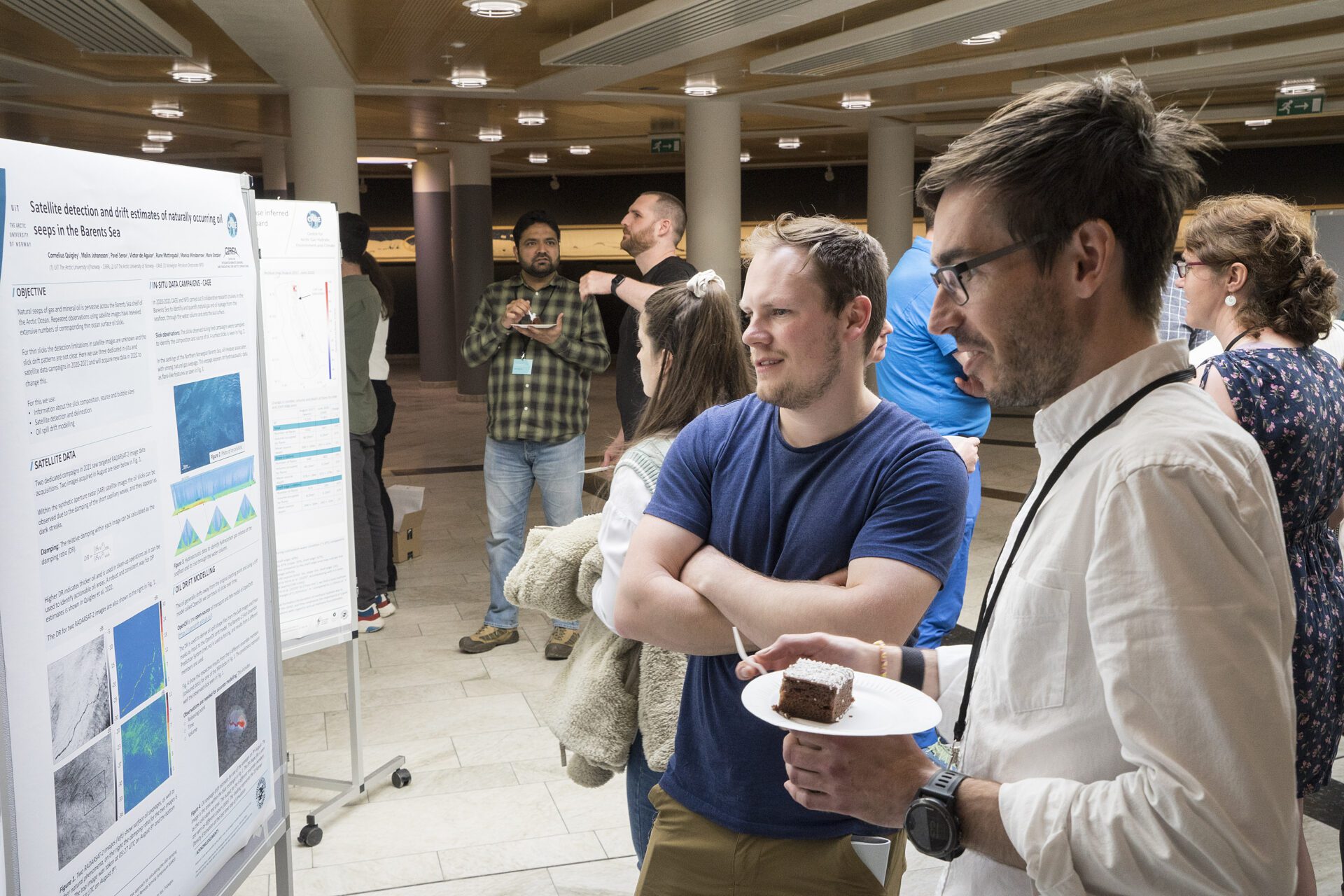
    Poster Session. Photo credit: Kai Mortensen.
    Poster Session. Photo credit: Kai Mortensen.
    Poster Session. Photo credit: Kai Mortensen.
    Poster Session. Photo credit: Kai Mortensen.
    Photo credit: Kai Mortensen.
  • AKMA-OceanSenses Expedition receives endorsement from UN Ocean Decade

    AKMA-OceanSenses Expedition receives endorsement from UN Ocean Decade

    Between 11-23 May 2022, the AKMA-OceanSenses Research Expedition will sail to the Barents Sea and Arctic Ocean to investigate extreme environments with a focus on both science and education.

    Text: Mariana Esteves

    The AKMA-OceanSenses Research Expedition, led by Professor Giuliana Panieri and Professor Stefan Bünz, has been endorsed by the UN Ocean Decade. The UN Ocean Decade aims to raise knowledge of the oceans, by stimulating and coordinating research efforts nationally and globally, in order to achieve the UN sustainability goal 14 – Life under water.

    Aboard the research vessel Kronprins Håkon, scientists, illustrators, musicians and educators will sail into the Barents Sea and Arctic Ocean between 11-23 May 2022. This expedition, organised by the AKMA (Advancing Knowledge of Methane in the Arctic) project, will investigate extreme environments, such as natural methane seep sites, acquiring new datasets that can improve our ability to better understand the present-day, and  therefore future environmental and climatic changes. However, investigating methane emissions is not the sole focus of this research cruise.

    With students, teachers, and researchers from all around the world (Norway, Italy, France, Kazakhstan, Portugal, Brazil, Tanzania and Botswana) able to digitally join this research cruise, a major focus for this expedition is to bridge the gap between science and education. Every other day, scientists and educators onboard this expedition will connect with classes from around the world, and share their experiences and teach about the ocean. During the expedition, scientists and educators will also work to develop educational and learning tools for everyone to experience the ocean using all our senses – touch, sight, smell, hearing and taste.


    To read more about the expedition and find out more about the research and initiatives happening onboard, please visit the AKMA project website.


    For more information about the UN Ocean Decade (in Norwegian), click here.


    And finally, don’t forget to follow the AKMA-OceanSenses Cruise through their story map! To view it in full screen, click here.
    
  • Knut Ola Dølven defends thesis on “Measuring Methane in the Arctic Ocean – From legal framework to time series analysis via technology innovation “

    Knut Ola Dølven defends thesis on “Measuring Methane in the Arctic Ocean – From legal framework to time series analysis via technology innovation “

    Knut Ola Dølven will publically defend his PhD thesis entitled, “Measuring Methane in the Arctic Ocean – From legal framework to time series analysis via technology innovation” on March 24th 2022 at UiT – The Arctic University of Norway. This work was funded by the Centre for Arctic Gas Hydrate, Environment, and Climate (CAGE) at UiT.

    The trial lecture and public defense will be streamed online.

    Trial lecture

    Public defense


    Popular scientific abstract

    To reach international agreement on solutions to solve climate change and a sustainable future, a thorough understanding of environmental processes is crucial. Methane seeping from the seabed in the Arctic Ocean can cause climate change and is not well understood and more data is needed. This thesis have approach this problem from mainly an oceanographic, but also legal perspective. An inter-disciplinary assessment show that the implementation of innovative technology is not currently being hampered by legal issues. Two long-term time series from two intense methane seep sites offshore West Spitsbergen show very high variability on short time-scales which highlights the potential for errors in budget estimates. Lower concentration towards winter is explained by stronger mixing and winter storms. We developed a new technique for monitoring seabed seepage using an acoustic ocean current meter and also a method for retrieving fast response data from slow response methane sensors.


    The plan for Knut Ola Dølven’s public defense for the PhD degree in Science, on March 24th 2022, is as follows:

    Trial lecture at 10:15 on the following topic:

     ‘The global carbon cycle’

    PhD thesis defense at 12:15:

    ‘Measuring Methane in the Arctic Ocean – From legal framework to time series analysis via technology innovation’


    PhD Thesis is published and available here.


    Supervisors:

    • Dr. Bénédicte Ferré,  Department of Geosciences (main supervisor)
    • Dr. Peter Linke, GEOMAR, Germany

    Evaluation Committee:

    • Associate professor Daniel Frank McGinnis, University of Geneva, Switzerland (1. Opponent)
    • Dr. Carolyn Graves, Centre for Environment Fisheries and Aquaculture Sciences (Cefas), UK (2. Opponent)
    • Professor Alfred Hanssen, Department of Geosciences, UiT (internal member and leader of the committee)

    Leader of the defense:

    • Vise Dean for Education Hilja Lisa Huru, Faculty of Science and Technology, UiT


    To read more about the findings of this research:

    Woker, H., Schartmüller, B., Dølven, K. O. & Blix, K. (2020). The law of the sea and current practices of marine scientific research in the Arctic. Marine Policy, 115, 103850. https://doi.org/10.1016/j.marpol.2020.103850

    Dølven, K. O., Ferré, B., Silyakova, A., Jansson, P., Linke, P., and Moser, M. (2022) Autonomous methane seep site monitoring offshore western Svalbard: hourly to seasonal variability and associated oceanographic parameters, Ocean Sci., 18, 233–254. https://doi.org/10.5194/os-18-233-2022

    Dølven, K.O., Vierinen, J., Grilli, R., Triest, J. & Ferre, B. (2021). Response time correction of slow response sensor data by deconvolution of the growth-law equation. Geoscientific Instrumentation, Methods and Data Systems, preprint, in review. Also available at https://doi.org/10.5194/gi-2021-28.

    Dølven, K.O. (2022). Replication data for Autonomous methane seep site monitoring offshore Western Svalbard: Hourly to seasonal variability and associated oceanographic parameters. DataverseNO, V1, https://doi.org/10.18710/CEIA1U.

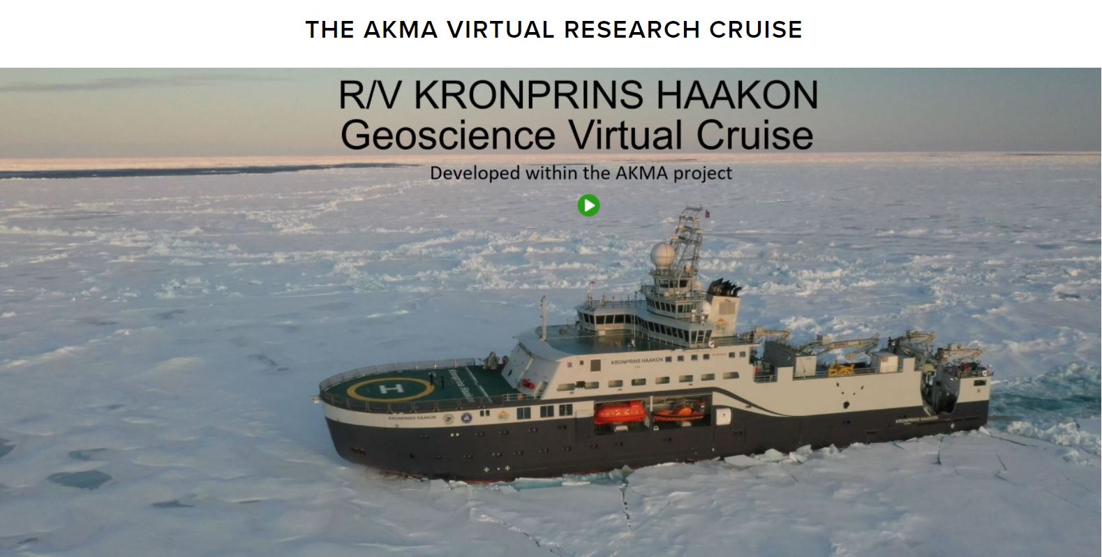
  • Welcome aboard our virtual research cruise!

    Welcome aboard our virtual research cruise!

    Have you ever dreamt of sailing into the Arctic and taking part in a research cruise? Have you ever wondered how scientists live and work when out at sea? Have you ever wondered how the R/V Kronprins Haakon looks like inside?

    If so, then look no further and check out the new AKMA project virtual research cruise!

    Text: Mariana Esteves

    The pandemic affected us all globally and so, when many of the participants for the first AKMA (Advancing Knowledge of Methane in the Arctic) cruise were unable to join the cruise Covid-19 restrictions, the idea to develop the virtual research (VR) cruise was born. Students and researchers from AKMA project, CAGE and UiT worked together to film and create an educational tool that can be used by anyone who wants to know what it is like to be a scientist on an Arctic research expedition.

    “We all know that real expeditions are unique, but the virtual one can be used for teaching, outreach, to prepare participants in getting familiar with the environment on-board, and for people with disabilities that differently could not join an expedition.” Says Giuliana Panieri, the leader for the AKMA project and cruise.

    The VR cruise on-board the R/V Kronprins Haakon can be explored both online through the web browser or with a virtual reality headset.  A total of 10 virtual reality headsets are available for schools to borrow, and they have already ventured around Europe and the world allowing students from several schools to explore the R/V Kronprins Haakon and virtual cruise. This is a unique experience for people of all ages, from school children to adults, to experience being on a research cruise and feel inspired for polar research.

    To find out more information on the virtual research cruise and how your school or research institute can get involved with this initiative, click here.

    To read the reflections of a project leader during the AKMA cruise, click here.

  • New state-of-the-art technology collects a unique time series from methane seeps in the Arctic

    New state-of-the-art technology collects a unique time series from methane seeps in the Arctic

    A new key publication in Ocean Science links cutting-edge technology with developments in our understanding of the environment and climate, highlighting and constraining uncertainties in current methane estimates coming from the seafloor.

    Text: Mariana Esteves

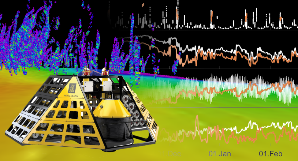
    At the forefront of ocean observatory technologies is the K-Lander – an innovative ocean observatory equipped with many ocean sensors, designed in collaboration between the water column group (WP4) at CAGE led by Bénédicte Ferré and Kongsberg Maritime. This observatory was designed to monitor methane release from the seabed to the water column under challenging environments, providing invaluable information on temporal and spatial variability of natural methane release that can potentially reach the atmosphere.

    A new study published in Ocean Science conducted by CAGE PhD candidate Knut Ola Dølven and co-authors presents time-series data from two methane seep sites offshore western Svalbard, in the Arctic. These unique results show high variability both on hourly and seasonal time-scales and describe the interconnectivity between methane seepage and the ocean.

    “The length and location are what makes these time-series unique, as they answer old and raise new questions related to this variability and how we can better constrain it in future emission estimates.” Says Knut Ola Dølven, Dølven, who conducted this study as part of his Ph.D. at CAGE.

    Areas of intense methane seepage

    In 2015 and 2016, two K-Lander observatories were deployed over distinct intensive methane seepage sites west of Prins Karls Forland, where thousands of gas bubble streams originating from the seafloor were observed.

    Location of the two K-landers deployed West of Svalbard, along with flare locations and ocean currents (WSC: West Spitzbergen Current, CC: Coastal Current). Credit: K.O. Dølven and M. Moser, CAGE/UiT

    Location of the two K-landers deployed West of Svalbard, along with flare locations and ocean currents (WSC: West Spitzbergen Current, CC: Coastal Current). Credit: K.O. Dølven and M. Moser, CAGE/UiT

    Despite the knowledge that methane seep sites likely experience high temporal and spatial variability, our understanding of the amount, distribution, and release of methane in the Arctic Ocean has largely relied on studies that were undertaken in the late spring to early autumn due to better ice and weather conditions. Until now.

    Long term monitoring of methane concentration

    Using data from the K-Lander, Dølven and co-authors processed a unique long time-series that spanned 10 months, measuring methane, carbon dioxide and physical parameters at each site. These measurements provided important insights into the short-term and seasonal variations of methane emissions and concentrations.

    “It was interesting to observe that, despite the very high short-term variability in methane release, the source of methane emission seemed to be relatively unchanged throughout the 10-month deployment. This has strong implications on future interpretations of methane concentration in seep areas.” Says Dølven.

    There is also increased potential for methane release to the atmosphere during the fall and winter, if seepage persists, due to the weaker water column stratification (increased mixing of the layers in the ocean).

    While seabed seepage is considered a minor natural source of atmospheric methane, there are large uncertainties related to the current and predicted emission estimates. Dølven and co-authors were, therefore, able to highlight and constrain uncertainties related to variability in methane inventory estimates from seabed methane seepage.

    Excitement on deck as the two K-Landers are being prepared for deployment. Credit: Manuel Moser

    Kongsberg technician, the Helmer Hanssen crew and Benedicte Ferré preparing the K-Lander for deployment. Credit: Manuel Moser


    K-Lander technology in future research applications

    This work highlighted the successful cooperation between maritime industry and research teams, providing cutting edge technology for monitoring methane to help explain questions on oceanic greenhouse gas emissions. This is the first long term data series providing exceptional multi-sensor data on methane release and other ocean physical and chemical conditions in the Arctic.

    “This infrastructure will play a major role in understanding factors controlling methane emissions not only in Arctic, as highlighted in this study, but in other locations worldwide as well. Methane seepage data in combination with other parameters measured by the K-Lander will help in estimating present and future global methane budgets in our oceans.” Says Bénédicte Ferré, the team leader for WP4 ‘Gas in the Water Column’ and EMAN7, and the responsible for the K-Lander.


    Reference: Dølven, K. O., Ferré, B., Silyakova, A., Jansson, P., Linke, P., and Moser, M.: Autonomous methane seep site monitoring offshore western Svalbard: hourly to seasonal variability and associated oceanographic parameters, Ocean Sci., 18, 233–254, https://doi.org/10.5194/os-18-233-2022, 2022.

    To read more about the K-Lander Observatory, click here.

  • CAGE International Conference on ‘Methane in a changing Arctic’

    CAGE International Conference on ‘Methane in a changing Arctic’

    The Centre for Arctic Gas Hydrate, Environment and Climate (CAGE) at UiT – The Arctic University of Norway welcomes your participation in the International Conference on Methane in a Changing Arctic, to be held in Tromsø, 14-16th September.

    This conference aims to bring together scientists working on all aspects of Arctic methane and its role in the global carbon cycle. It will provide an interdisciplinary forum for discussion and exchange of knowledge relating to our current understanding of these complex systems and their response to and impact on, the rapid environmental and climatic changes that characterise the Arctic.

    The conference will address themes including the formation, storage, cycling, transport, release and budgets of methane through the Arctic geo-, hydro-, cryo- and atmosphere since the onset of Northern Hemisphere glaciation and towards the future. The Conference will have a strong emphasis on integration of these themes, and we encourage all relevant contributions to the following topics:

    • Methane in the geosphere: subsurface thermogenic, (a-)biogenic and methane stores and sinks
    • Methane in the hydrosphere: methane processes and budgets in marine and lacustrine settings
    • Methane in the cryosphere: methane dynamics in ice sheets and permafrost
    • Methane in the atmosphere: methane source, sinks, and budget in the atmosphere
    • Microbial cycling of methane: the role of microbes in methane budgets
    • Past methane histories: past methane processes and budgets as analogues for future climate scenarios

    FOR UPDATED INFORMATION PLEASE VISIT OUR NEW CONFERENCE WEBSITE: https://site.uit.no/methane-in-a-changing-arctic/

    IMPORTANT DATES
    Abstract submission deadline:
    20th June 2022

    Registration deadline:
    14th August 2022


    Do you have any questions?

    If so, contact Mariana Esteves (mariana.esteves@uit.no)

  • CAGE Invites Conference – 31st May 2022

    CAGE Invites Conference – 31st May 2022

    In its final year as a Centre of Excellence, the Centre for Arctic Gas hydrate, environment and climate (CAGE) will organise the CAGE Invites Conference (Tuesday 31st May 2022) to put a focus on the ‘Changing Arctic: Ocean, Ice, and Climate’.
    With several keynote speakers from the Tromsø Arctic research community, this conference will present work related to the changing Arctic, from identifying the physical changes (past, present, and future), to the societal implications, and mitigation efforts.
    Understanding the changes occurring in the Arctic requires collaborative and interdisciplinary action. We, therefore, would like to invite and encourage all those interested, to contribute to the discussion, either by attending and/or presenting a poster.

    More information below.


    Click to expand the flyer and view it in full resolution. 

    More information
    How can I sign up?

    Sign up to attend using the registration form link below.
    Registration form (deadline extended to 22nd April!): https://nettskjema.no/a/239415

    You can provide information regarding

    Registration fee

    There is no registration fee for this event. This also includes those who have registered to have lunch/finger food.

    Can I attend without presenting?

    Yes! Of course, we welcome everyone to join us! Just sign up through the online registration form (deadline extended to 22nd April!): https://nettskjema.no/a/239415

    Will the presentations be streamed online?

    Yes! Please register by the deadline and we will send the link to the event nearer the day.

    Do you have dietary requirements or allergies?

    Please notify us using your registration form.


    Information and deadlines for presenters

    Please upload your abstracts using the attachment link on the registration form by the 31st March. If you have difficulties with this, send the abstract to Mariana Esteves (mariana.esteves@uit.no).

    Keynote speakers

    Please send your completed presentations to Mariana Esteves (mariana.esteves@uit.no), no later than 23rd May.

    Each presentation should be less than 15 mins to allow time for questions.

    Poster presentations

    There is no restriction on the size of the posters, although ideally no bigger than A0. If you use something that cannot be put up using tape or white tack, please bring your own stand/attachments. We will have volunteers who can help you put these up. The posters should be put up before the start of the conference (10am, 31st May). There will be volunteers to help at Solhallen (outside of Auditorium 1) from 08:30.


    Do you have any additional questions?

    If so, contact Mariana Esteves (mariana.esteves@uit.no)

  • Siri Ofstad defends thesis on “Arctic planktonic calcifiers in a changing ocean”

    Siri Ofstad defends thesis on “Arctic planktonic calcifiers in a changing ocean”

    Siri Ofstad will publically defend her PhD thesis entitled, “Arctic planktonic calcifiers in a changing ocean – A study on recent planktonic foraminifera and shelled pteropods in the Fram Strait-Barents Sea region” on December 16th 2021 at UiT – The Arctic University of Norway. This work was funded by the Centre for Arctic Gas Hydrate, Environment, and Climate (CAGE) at UiT.

    The trial lecture and public defense will be streamed online.


    Popular scientific abstract

    The Arctic is changing. Small organisms (planktonic foraminifera and shelled pteropods) in the water column were studied in terms of their abundance, seasonality, diversity, life cycles, and calcification. This was done by collecting samples with a plankton net and collecting water and surface sediments. This thesis has shown that the Fram Strait-Barents Sea region is characterized by low species diversity and marked seasonality. We found a decrease in the relative abundance of the polar species Neogloboquadrina pachyderma on the Greenland shelf compared to the 1990s, and sub-tropical species in the Barents Sea. This thesis has helped in filling gaps in research into the impacts of ocean acidification in the Arctic. Lastly, we have been able to show that organisms in the same size class and water depth have a wide range of shell densities which is also true for foraminifera in surface sediments. These two points may complicate geochemical or ocean acidification studies as well as paleo-studies.


    The plan for Siri Ofstad’s public defense for the PhD degree in Science, on December 16th 2021, is as follows:

    Trial lecture at 10:15 on the following topic:

     ‘The role of marine calcifiers in the ocean carbon and carbonate pumps; past, present, and future’

    PhD thesis defense at 12:15:

    ‘Arctic planktonic calcifiers in a changing ocean – A study on recent planktonic foraminifera and shelled pteropods in the Fram Strait-Barents Sea region’


    PhD Thesis is published and available here.


    Supervisors:

    • Professor Tine L. Rasmussen, Department of Geosciences, UiT
    • Dr. Kasia Zamelczyk, Department of Geosciences, UiT
    • Dr. Julie Meilland, MARUM, University of Bremen

    Evaluation Committee:

    • Professor Ulysses Ninnemann, Department of Geosciences, UiB, Norway (1. Opponent)
    • Senior Research Scientist Dr. Clara Manno, British Antarctic Survey, UK (2. Opponent)
    • Researcher Dr. Mohamed M. Ezat, Department of Geosciences, UiT (internal member and leader of the evaluation committee)

    Leader of the defense:

    • Professor Alfred Hanssen, Department of Geosciences at Faculty of Science and Technology


    To read more about the findings of this research:

    Ofstad, S., Meilland, J., Zamelczyk, K., Chierici, M., Fransson, A. & Rasmussen, T.L. (2020). Development, productivity, and seasonality of living planktonic foraminiferal faunas and Limacina helicina in an area of intense methane seepage in the Barents Sea. Journal of Geophysical Research: Biogeosciences, 125(2), e2019JG005387. Also available in Munin at https://hdl.handle.net/10037/17522.

    Ofstad, S., Zamelczyk, K., Kimoto, K., Chierici, M., Fransson, A. & Rasmussen, T.L. (2021). Shell density of planktonic foraminifera and pteropod species Limacina helicina in the Barents Sea: Relation to ontogeny and water chemistry. PLOS One, 16(4), e0249178. Also available in Munin at https://hdl.handle.net/10037/21744.

  • Interactive story map for polar night research cruise

    Interactive story map for polar night research cruise

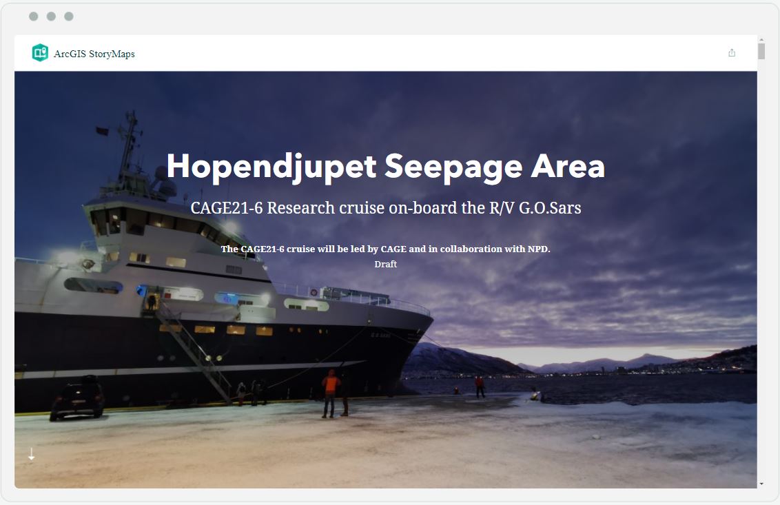
    On the 5th December, the CAGE21-6 cruise, led by Associate Professor Monica Winsborrow and Dr Jochen Knies, set off from Tromsø and headed north towards the central Barents Sea. The aim was to investigate the Hopendjupet Seepage Area, an area known for intense methane flaring, with an ROV for the first time.

    This 11-day polar night and multi-disciplinary CAGE cruise is in collaboration with NPD, and has cruise participants from numerous institutes including CAGE, UiT, NPD, NGU, and UNIS.

    For this cruise, a new style of cruise blogging is being used: an interactive story map.  The CAGE21-6 cruise blog has already many contributions from numerous of the cruise participants.


    To follow the CAGE21-6 Cruise blog:

    CAGE21-6 cruise blog with the interactive map in full screen:  https://arcg.is/1nanqi
    CAGE cruise website (where the cruise report will be stored eventually): https://site.uit.no/cage/cruise/hopendjupet-seepage-area-21-6/

  • Geochemical measurements using the CAGE Mass Spectrometer contributes to high impact climate research

    Geochemical measurements using the CAGE Mass Spectrometer contributes to high impact climate research

    Using the elements in the ocean, marine invertebrates and single-celled organisms, such as bivalves and foraminifera, are able to build elaborate shells that record the properties of their surrounding environment. By studying the chemical composition of the shells using a mass spectrometer, scientists can reconstruct past ocean temperatures and environments, and study the evolution of methane seepages.

    These reconstructions are key to understanding the present and future climate changes.

    (more…)

  • Vincent Carrier defends thesis on “Microbial community structure associated to Arctic cold seeps”

    Vincent Carrier defends thesis on “Microbial community structure associated to Arctic cold seeps”

    Vincent Carrier will publically defend his PhD thesis entitled, “Microbial community structure associated to Arctic cold seeps” on November 29th 2021 at UiT – The Arctic University of Norway. This work was funded by the Centre for Arctic Gas Hydrate, Environment, and Climate (CAGE) at UiT.

    The trial lecture and public defense will be streamed online.


    Popular scientific abstract

    Cold seeps are locations on the seafloor where CH4 migrates from reservoirs below sediments towards the atmosphere, sustaining thereby a high microbial and macrofaunal biomass and a diversity contrasting from the surrounding seafloor. The oxidation of methane and sulphide are typically the main sources of primary productivity of these ecosystems and have therefore gained a particular attention in the global oceans. Yet, despite the ubiquitous presence of these seeping sites and the presence of gas hydrates in the Arctic Ocean and its adjacent shelves, the impact of methane on benthic and pelagic microbial communities in this region have remained limited. Recently, five gas hydrate bearing mounds with ongoing methane seeping activity were discovered south of Svalbard, in the northern Barents Sea. In this PhD project, I studied changes in the structure of microbial communities, including both prokaryotes and eukaryotes, and geochemical profiles at these mounds to highlight key microbial groups and to provide insights on their ecological roles. Different niches were addressed, including: deep anaerobic sediments (Paper I and II); niches at the sediment surface at gas flare locations and within bacterial mats and siboglinid fields (Paper III); and above gas flares in the shallow shelf water column (Paper IV). The microbial biodiversity and the structure of communities were successfully identified for each of the habitats listed above. Our investigations revealed a microbial composition similar to other cold seeps: a predominance of archaeal anaerobic methanotrophs (ANME) and sulphate-reducing bacteria (SRB) in CH4-rich sediments, a higher abundance of methane oxidizing bacteria associated to the Methylococcales in the surface sediments and water column; and a co-occurrence of other commonly found prokaryotic groups. Yet, uncommon biological traits were also uncovered at these methane seeping sites: the anaerobic oxidation of methane was merely only driven by ANME-1 without the co-occurrence of a specific SRB clade; an abundant methanotroph with little genetic similarity in databases was detected; and a strong niche differentiation of sulphide-oxidizing bacteria within the different bacterial mats. This project has thereby extended our knowledge on the microbial biodiversity at Arctic cold seeps and opened further future research perspective toward microbial activity and metabolism at these high latitudes.


    The plan for Vincent Carrier’s public defense for the PhD degree in Science, on November 29th 2021, is as follows:

    Trial lecture at 10:15 on the following topic:

     ‘Deep sea sediment microbial processes, key taxa, and interactions’

    PhD thesis defense at 12:15:

    ‘Microbial community structure associated to Arctic cold seeps’


    PhD Thesis is published and available here.


    The methane oxidising bacterium Methyloprofundus sedimenti. It was isolated from sea water along the west coast of Svalbard. Picture: Mette Marianne Svenning and Rudi Caeyers, UiT The Arctic University of Norway


    Supervisors:

    • Professor Mette Svenning, Department of Arctic and Marine Biology
    • Associate Professor Dimitri Kalenitchenko, Department of Geosciences
    • Researcher Friederike Gründger, Aarhus University, Denmark
    • Professor Helge Niemann, Royal Netherlands Institute for Sea Rsearch and Utrecht University, Switzerland

    Evaluation Committee:

    • Associate Professor Håkon Dahle, University of Bergen (1 opponent)
    • Associate Professor Mylène Hugoni, University Claude Bernard Lyon 1, Frankrike (2 opponent)
    • Professor Rolf Gradinger, AMB (internal member and leader of the committee)

    Vincent (bottom right) together with supervisors and opponents. Photo credit: Marie Stetzler.


    To read more about the findings of this research:

    Gründger, F., Carrier, V., Svenning, M.M., Panieri, G., Vonnahme, T.R., Klasek, S. & Niemann, H. (2019). Methane-fuelled biofilms predominantly composed of methanotrophic ANME-1 in Arctic gas hydrate-related sediments. Scientific Reports, 9, 9725. Also available in Munin at https://hdl.handle.net/10037/16225.

    Carrier, V., Svenning, M.M., Gründger, F., Niemann, H., Dessandier, P.A., Panieri, G. & Kalenitchenko, D. (2020). The Impact of Methane on Microbial Communities at Marine Arctic Gas Hydrate Bearing Sediment. Frontiers in Microbiology, 11, 1932. Also available in Munin at https://hdl.handle.net/10037/19507.

    Gründger, F., Probandt, D., Knittel, K., Carrier, V., Kalenitchenko, D., Silyakova, A., … Niemann, H. (2021). Seasonal shifts of microbial methane oxidation in Arctic shelf waters above gas seeps. Limnology and Oceanography, 66(5), 1896-1914. Also available in Munin at https://hdl.handle.net/10037/21556.

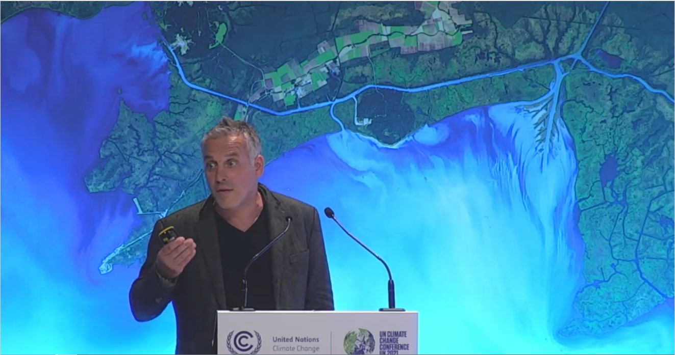
  • CAGE/UiT professor delivers key Arctic message to COP26 Climate Summit

    CAGE/UiT professor delivers key Arctic message to COP26 Climate Summit

    World leaders and chief executives from industry and business are gathered in Glasgow this last week for the COP26 Climate Summit.  Here, critical policy decisions are being hammered out that will impact all of us regarding future fossil fuel emissions and time-frames for neutralizing carbon-based economies.

    (more…)

  • Radiograph of a bivalve

    Radiograph of a bivalve

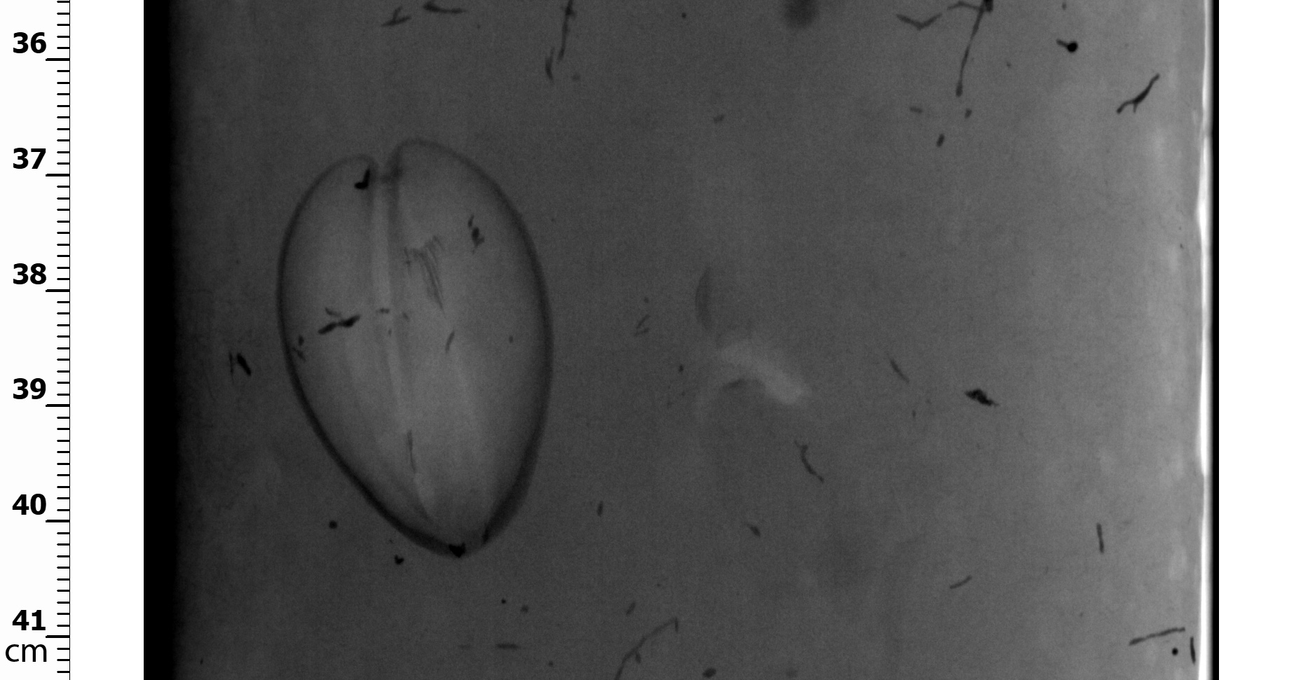
    Novembers photo of the month picture has been submitted by CAGE & AKMA Post Doctoral Fellow Claudio Argentino.

    X-ray scans (radiographs) of sediment cores are used to identify structures and lithological units. Although it is not uncommon to observe broken fossil shells in sediment cores, it is quite rare to visualize intact specimens! Further analysis will reveal the identity of this bivalve and whether its origin is linked to methane seepage.

  • Warmer bottom water temperatures increased methane seepage in the NW Barents Sea

    Warmer bottom water temperatures increased methane seepage in the NW Barents Sea

    Over the last 18,000 years, there have been phases of extreme bottom water temperatures reaching up to 6°C. The inflow of warmer Atlantic Waters onto the continental shelf during these phases has been associated with repeated changes in the stability of subsurface gas hydrates, facilitating the release of greenhouse gasses from the seabed, and triggering multiple collapses of the past ice sheet.

    Text: Mariana Esteves

    (more…)

  • Katarzyna Melaniuk defends thesis on ‘Assessing the relationship between living benthic foraminifera and methane emissions in the Arctic Ocean’

    Katarzyna Melaniuk defends thesis on ‘Assessing the relationship between living benthic foraminifera and methane emissions in the Arctic Ocean’

    Katarzyna Melaniuk will publically defend her PhD thesis entitled, ‘Assessing the relationship between living benthic foraminifera and methane emission in the Arctic Ocean’ on November 4th 2021 at UiT – The Arctic University of Norway. This work was funded by the Centre for Arctic Gas Hydrate, Environment, and Climate (CAGE) at UiT.

    The trial lecture and public defense will be streamed online.

    Popular scientific abstract

    Methane is a powerful greenhouse gas. In marine environments, it is buried deep in the sediments in the form of gas hydrate, an ice-like structure. Due to its form, gas hydrate is sensitive to changes in temperature and pressure. Because of that, the ongoing climate change can trigger destabilization of its sub-seabed deposits. This may result in a release of great amounts of methane into the atmosphere. Methane seepage events have occurred in the past and were recorded in the isotopic signature of calcareous tests (shells) of fossil foraminifera. However, not much is known about the possible impact of methane-affected sediments on the living foraminiferal fauna, e.g. in the cold seeps. Due to the hostile conditions within a cold seep, such as low oxygen and elevated carbon dioxide concentration, it remains unclear if benthic foraminifera build their tests during methane emission events and whether, and to what extent, live foraminifera incorporate methane-derived carbon during biomineralization. This knowledge is crucial to establish foraminifera as a reliable tool in tracking methane emissions. The main focus of this thesis was to investigate the response of foraminifera to the combined effect of low oxygen and elevated carbon dioxide concentration in a laboratory setting, replicating conditions that commonly occur in cold seeps. Secondly, this thesis investigates modern foraminiferal assemblages using fluorescence viability assays and a conventional method, Rose Bengal staining. Fluorescence probes react exclusively with metabolically active foraminifera, and so this method distinguishes live foraminifera from the recently dead individuals, creating a more detailed picture of the modern foraminiferal fauna in the study area. Finally, I was able to determine that methane-derived carbon can shift the δ13C signature of living (Rose Bengal-stained) foraminifera towards lower δ13C values, which is linked to methane-related processes, such as aerobic (MOx) and anaerobic methane oxidation (AOM). Active methane seepage did not markedly affect the isotopic signature (δ13C) of primary calcite in metabolically active foraminifera in this study. This work not only advances our understanding of the mechanisms of foraminiferal response to methane seepage events but also facilitates their use in future studies of methane emissions.


    The plan for Katarzyna Melaniuk public defense for the PhD degree in Science, on November 4th 2021, is as follows:

    Trial lecture at 10:15 on the following topic:

     ‘Benthic foraminifera as indicators of natural and/or anthropogenic pollution in the Arctic’

    PhD thesis defense at 13:15:

    ‘Assessing the relationship between living benthic foraminifera and methane emission in the Arctic Ocean’


    PhD Thesis is published and available here.

    Supervisors:

    • Professor Tine L. Rasmussen, Department of Geosciences, UiT (main supervisor)
    • Professor Tina Treude, Department of Earth, Planetary and Space Sciences, University of California Los Angeles (UCLA), USA
    • Professor Marek Zajaczakowski, Institute of Oceanography of the Polish Academy of Sciences (IOPAN), Poland

    Evaluation Committee:

    • Professor Marit-Solveig Seidenkrantz, Department of Geoscience, Aarhus University, Denmark (1. Opponent)
    • Jeroen Groeneveld, Hamburg University, Office address: Bremen University, Germany (2. Opponent)
    • Researcher Dr. Steffen Aagaard Sørensen, Department of Geosciences, UiT (internal member and leader of the committee)


    To read more about the findings of this research:

    Melaniuk, K. (2021). Effectiveness of Fluorescent Viability Assays in Studies of Arctic Cold Seep Foraminifera. Frontiers in Marine Science, 8, 587748. https://doi.org/10.3389/fmars.2021.587748


  • HACON project pioneers 4km deep explorations of underwater volcanoes under permanent Arctic Ice cover

    HACON project pioneers 4km deep explorations of underwater volcanoes under permanent Arctic Ice cover

    Longyearbyen, Norway. Oct 25, 2021.

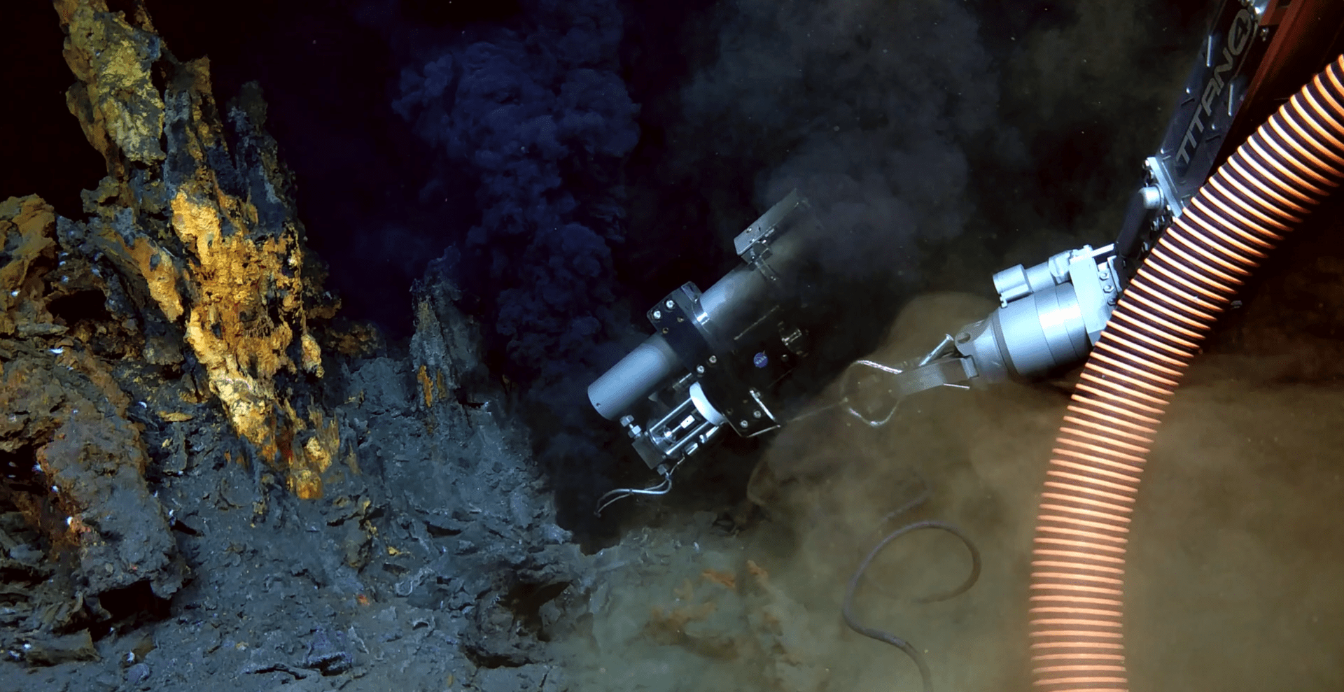
    At the Aurora hydrothermal vent field, 82.5N, the HACON project successfully sampled rocks, fluids, sediments and fauna for geological, geochemical, micropaleontological, microbial, meiofauna and macrofauna studies to better understand the functioning of the deep Arctic Ocean.

    An exceptional team of researchers has taken a major step forward in deep-sea exploration by sampling and filming one of Earth’s last truly remote and inaccessible environments deep below the permanent ice. This is the first-time hydrothermal vents, also known as underwater volcanoes,  have been successfully investigated this far north. This work provides a baseline of information prior to the anticipated onset of commercial activity in the Arctic as a consequence of retreating ice cover. The analysis of the samples will allow researchers to assess if the fauna has evolved in isolation in the Arctic Ocean or if it is connected to other ocean basins. In addition, the data will provide a glimpse of how early life formed on Earth, and stir high interest in space exploration and the search for extra-terrestrial life in our solar system.

    The Aurora Hydrothermal vent field is located in The Arctic Ocean at 82.5N.

    The HACON 2021 expedition is the first time such a unique environment has been successfully explored and sampled in detail beneath permanent polar sea ice, opening the path for future international exploration of the remote Gakkel Ridge.

    From September 28th to October 21st the HACON 2021 expedition, led by CAGE/UiT (The Arctic University of Norway) and the Norwegian Institute for Water Research (NIVA), brought together a diverse and multi-national team of 28 scientists, engineers and communication experts aboard the icebreaker RV Kronprins Haakon to explore ‘black smoker’ hydrothermal vents in one of the most inaccessible vent fields on the planet, the Aurora vent field on the Gakkel Ridge at 4000m depth. The vents are called black smokers because of the dark, ‘smoke-like’, super-heated liquid (over 300C) that emits from chimney-like structures.

    HACON21 expedition participants

    The Aurora vent field was first detected 20 years ago, when hydrothermal rock material was dredged from the seafloor. It remained unexplored until 2014, when the first visual confirmation of the active black smokers was obtained during a German cruise led by Prof Antje Boetius (AWI). The HACON team revisited this site in 2019 providing additional high-resolution images of the hydrothermal vent field obtained with a towed camera. The team was unable to directly sample the site with an ROV (Remote Operated Vehicle) due to the technical challenges of working in thick, drifting ice conditions.


    This time was different.

    Despite thick and highly concentrated sea ice, the cruise has been a tremendous success in terms of observing and sampling the vent site. One of the main pieces of equipment used was a new ROV, aptly named “Aurora”, provided by REV Ocean. This was the first time the ROV was used. A strong team effort requiring tremendous coordination from the ship’s Captain and Officers, science team, ROV pilots and crew, resulting in the first detailed visual survey and mapping of the Aurora Vent Field and collection of more than 100 visual, geological, geochemical, and biological samples.

    Return of the ROV ‘Aurora’ 

    The samples taken of high-temperature fluids, chimney rock, sediments and fauna will now be analysed at laboratories in the partner institutes to get a better understanding of the composition and functioning of the vents. The teams have already expressed high confidence of new discoveries and intend to submit a succession of articles in peer-reviewed academic journals in the coming years.

    Forty years after the first discovery of deep-sea hydrothermal vents, the HACON21 cruise has added a wealth of visual material and physical samples of the first hydrothermal vents ever studied in the Arctic Ocean under ice. This data helps to complete one of the missing pieces of the global biogeographic puzzle of vents around the globe. The excellent collaborative atmosphere onboard facilitated significant sharing of samples amongst the groups. These activities strengthened existing partnerships, as well as established new ones amongst many of the teams from the different national and international institutions.

    A key goal going forward is to use the results to work together on challenges and solutions related to Vulnerable Marine Ecosystems and Marine Protected Areas. This will result in new science provided to intergovernmental initiatives such as the UN conference on the conservation and sustainable use of marine biological diversity in areas beyond national jurisdiction, the UN Sustainable Development Goals and the UN Decade for Ocean Science, in particular the Challenger 150 programme.

    Sampling at the Aurora Hydrothermal Vent field


    Background
    The AMORE 2001 expedition (US) located the Aurora vent field collecting chemical signal of the hydrothermal plume in the water column. In 2014, the Polarstern (PS86) cruise from AWI (Germany) observed the first black smoker, and the specific locations of the black smoker positions were obtained during OFOBS dives throughout the HACON 2019 cruise.

    The main black smoker, the “Hans Tore Vent”, was named in honor of Prof Hans Tore Rapp, a world-leading deep-sea biologist from the Uni Bergen, who passed away in 2020 and was a key member of the HACON team.


    Funder
    The FRINATEK programme, funded by the Norwegian Research Council, provides the necessary funding framework from which to develop high risk-high gain projects that can greatly advance science. The shiptime was provided by the Uni. Tromsø. HACON project partners and collaborators participated from CAGE-Uni. Tromsø, the Norwegian Institute for Water Research, University of Bergen, the Institute of Marine Research, the University of Aveiro (Portugal), Woods Hole Oceanographic Institution (USA), the Alfred Wegner Institute (Germany), NASA-JPL (USA), Memorial University (Canada)and the University of Southampton (UK).


    Blog
    www.revocean.org/HACON21
    Ref doc: cruise report 2021
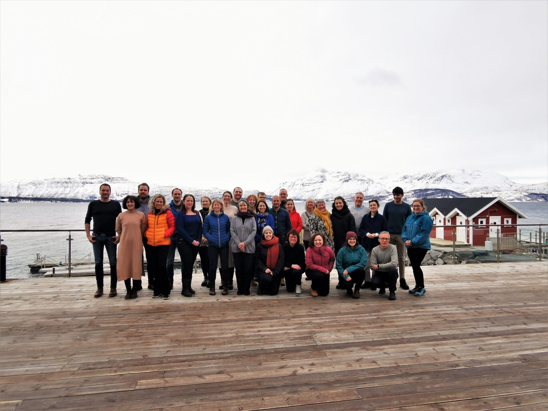
  • In-situ horizontal pressure measurements at deep marine seafloor methane emission off west-Svalbard

    In-situ horizontal pressure measurements at deep marine seafloor methane emission off west-Svalbard

    Why gas emissions from the seafloor have stopped thousands of years ago in some areas along the Vestnesa sedimentary ridge, while persisting exclusively on the eastern part of the ridge, is the question that drives our scientific objectives in this campaign.


    Text: Andreia Plaza-Faverola, leader. SEAMSTRESS project.


    The answer to this question is likely related to the type of sediment and the disposition of the sediment to fracture. To investigate this further we need to measure sediment properties such as in-situ pore fluid pressures, horizontal stress and shear strength. Conducting these measurements is not so easy because it requires expensive and technically challenging instrumentation. The SEAMSTRESS project assumes the challenge of conducting the geotechnical experiments that are lacking to understand the pressure behavior at deep marine seafloor seepage systems in our favorite Arctic laboratory: The Vestnesa Ridge. These challenging experiments are the core of SEMSTRESS which main objective is to advance knowledge on the pressure (stress) field that controls seafloor methane emissions.

    In a collaboration with MSH – Marine Sampling Holland and the Marchetti laboratory we are planning to deploy the Medusa dilatometer designed by the Marchetti Lab to measure in-situ the pressure of the Earth at ease and therefore the horizonal stress. To deploy this instrument offshore there is need for a seafloor sort of rig. We intend to use Geomil’s Manta 200 rig, an instrument designed for conducting cone penetration tests in the soil. Geomil started developing this type of instrumentation in the 30s to help the Netherland overcome a struggle with railway failures due to soft sediment.

    Manta is a big machine, heavier than anything that has been deployed so far from R/V Kronprins Haakon. The machine also has a power supply requirement that differs from what the ship can provide. Our mission therefore starts with a few days in the fjord working hard to overcome all the technical challenges to get the machine ready for deployment before sailing offshore.


    The Geomil’s Manta-200 rig for Cone Penetration Test (CPT) in position while the MSH team together with the ship crew prepare the winches and solvent challenges with the power supply.

  • Naima El Bani Altuna defends thesis on millennial-scale variability of the Atlantic water inflow in the Nordic Seas and the Barents Sea

    Naima El Bani Altuna defends thesis on millennial-scale variability of the Atlantic water inflow in the Nordic Seas and the Barents Sea

    Naima El Bani Altuna will publically defend her PhD thesis entitled, ‘Millennial-scale variability of Atlantic water inflow in the northern Nordic Seas and the northwestern Barents Sea – Relationship to abrupt climate oscillations, cryosphere and methane seepage from the seafloor’ on September 17th 2021 at UiT – The Arctic University of Norway. This work was funded by the Centre for Arctic Gas Hydrate, Environment, and Climate (CAGE) at UiT.

    The trial lecture and public defense will be streamed online.

    Popular science abstract

    Climate change is increasing Arctic air-temperatures very fast – twice as fast the rest of the world’s temperature. This is also affecting the ocean at high latitudes, where powerful greenhouse gases are stored in the seafloor trapped in ice-like cages (known as gas hydrates), that can melt if the temperature of the ocean increases. To understand how the ocean and the climate are connected, in this thesis we looked back in time to periods of rapid climate change during the last ice age, when temperature increased at a similar rate as modern. For that purpose, we studied the evolution of warm Atlantic water entering the northern Nordic Seas and the western Barents Sea using the chemical composition of shells of benthic foraminifera (microscopic single-celled organisms living in the seafloor).

    In the northern Nordic Seas, we have also reconstructed sea-ice variability. We found that during cold atmospheric periods the ocean was warm (up to 5°C) because meltwater released from icebergs, and a sea-ice “lid” formed by the cold temperatures trapped the heat beneath. Instead, during warm periods the seafloor remained cooler with similar temperatures to modern. Furthermore, our work shows that both the disappearance of the sea-ice “lid” and the decrease of oceanic temperatures happened at the same time during the cold periods, which suggest a strong connection between both parameters. In the Barents Sea we focused on investigating the effect of the inflow of warm Atlantic water on gas hydrates in the seafloor. The Atlantic water did indeed affect the stability of gas hydrates, enhancing the melting of these compounds and causing the release of gas from the seafloor to the water column.

    This study has improved our understanding of how the past inflow of warmer Atlantic water connects to past abrupt climate changes. Additionally, it has shed light on the relationship between Atlantic water and the stability of gas hydrates.


    The plan for Naima El Bani Altuna public defense for the PhD degree in Science, on September 17th 2021, is as follows:

    Trial lecture at 13:15 on the following topic:

     ‘Gas hydrate seeps – their impact on climate and interaction with ocean temperatures through time’

    PhD thesis defense at 15:15:

    ‘Millennial-scale variability of Atlantic water inflow in the northern Nordic Seas and the northwestern Barents Sea – Relationship to abrupt climate oscillations, cryosphere and methane seepage from the seafloor’


    PhD Thesis is published and available here.


    Supervisors:

    ·         Professor Tine L. Rasmussen, Department of Geosciences, UiT (main supervisor)

    ·         Researcher Dr. Mohamed Ezat, Department of Geosciences, UiT

    Evaluation Committee:

    ·         Professor Dr. Marit-Solveig Seidenkrantz, Department of Geoscience, Aarhus University, Denmark (1. opponent)

    ·         Senior Research Associate Dr. Anne Jennings, University of Colorado Boulder, USA (2. opponent)

    ·         Researcher Dr. Amando Putra Ersaid Lasabuda, Department of Geosciences, UiT (internal member and leader of the committee)

    Left to Right: Professor Dr. Marit-Solveig Seidenkrantz, Researcher Dr. Amando Putra Ersaid Lasabuda, Dr Naima El Bani Altuna, Professor Tine L. Rasmussen, and Researcher Dr. Mohamed Ezat


    To find out more about the findings of this research:

    El bani Altuna, N., Ezat, M. M., Greaves, M., & Rasmussen, T. L. (2021). Millennial-scale changes in bottom water temperature and water mass exchange through the Fram Strait 79°N, 63-13 ka. Paleoceanography and Paleoclimatology, 36, e2020PA004061. https://doi.org/10.1029/2020PA004061

    El bani Altuna, N., Rasmussen, T.L., Ezat, M.M. et al. Deglacial bottom water warming intensified Arctic methane seepage in the NW Barents Sea. Commun Earth Environ 2, 188 (2021). https://doi.org/10.1038/s43247-021-00264-x

  • Return from the forest of the 10,000 flares

    Return from the forest of the 10,000 flares

    Text and photos: Mauro Pau

    A fun moment during the working on the just acquired core.

    Here are some personal impressions from cruise CAGE21-4 to the central Barents Sea. Let’s start with the negatives. Unless this cruise was sponsored by a known milk brand, there is no excuse UiT cannot provide decent quality drinking water to its employees. A few of those big water jugs can only be beneficial for future cruises on R/V Helmer Hanssen.

    Sediment for headspace gas analysis is sampled from the freshly exposed base of a core section.

    Apart from that, what a valuable experience it has been. I enjoyed the hands-on working, for instance when collecting sediment samples for headspace gas analysis, which I had never done before. I am also glad for the practice gained at multibeam water column image interpretation while picking gas flares (altogether we identified over ten thousand flares).

    Henry brings a core section into the lab.

    Preparation of the core for storage.

    This cruise has been filled with many moments of awe. On one occasion, I was drawing porewater into vials containing mercury chloride (the most toxic chemical I have ever used), and saw them turning each a different shade of yellow, reflecting increasing sulphide concentration downcore. Sulphide is a product of the aerobic oxidation of methane in the sediments, so just by looking at the colour of the vials one can infer that there is a strong methane flux in that environment.

    Porewater is collected from cores using rhizon samplers, polymer tubes inserted into the sediment and fitted to low-pressurised syringes.

    Mercury chloride is an extremely toxic chemical, and we add it to stop microbial activity in porewater samples. Incidentally, it reacts with sulphide ions forming mercury sulphide, a solid precipitation of yellow colour. The darker the yellow, the higher concentration of sulphide.

    We spotted several whales and dolphins along our way. One memorable scene was when an oil sampling trip on the dinghy boat turned into a whale safari. A finback whale at least three times the size of the boat materialised out of the blue. We were struck by her sound; the photo does not do justice to how amazing it was to be there.

    A finback whale pays us a visit and inquires about our research.


    Fishcakes and porridge for breakfast has been yet another experience, most likely a unique one, though I’m glad I can now brag about it.

  • Shifting focus to a glaciological perspective

    Shifting focus to a glaciological perspective

    Text and photos: Henry Patton


    Our final 24 hours of this research expedition will shift focus from hydrocarbon-based aspects to a more glaciological perspective. This also means a transit to a new area, to the nearby glacial trough of Sentralbankrenna, which around 15,000 years ago hosted one of the last major outlet glaciers of the retreating Barents Sea ice sheet. As the Earth thawed at the end of the last ice age, rising air and ocean temperatures triggered the collapse of the once 3-km thick ice sheet that covered most of the Barents Sea and NW Europe. Sentralbankrenna was one of the last areas to deglaciate due its location in the central Barents Sea, and so the geological information left behind here can tell us much about the processes of why and how such large marine-terminating glaciers can disappear under times of rapid climate change.

    I visited this area previously in 2020, where we managed to collect some multibeam echosounder data showing some tantalising snapshots of the glacial deposits and landforms left behind on the sea surface. Our plan is to supplement this data and fill in some of the many gaps still left behind – yet with limited time on our side and Sentralbankrenna being a very large trough some 100 km wide, our decision for where to survey becomes remarkably difficult.


    Figure 1: Multibeam echosounder (MBES) data tells us what the seafloor looks like in high resolution. In Sentralbankrenna our swath – our window of the seafloor – is c. 1 km wide. Source: Wikipedia.


    After some debate on the best strategy we decide to focus on two areas, one over what appears on low resolution data to be an interesting complex of hummocky topography where a glacier may have once terminated, and the other over what could be a subglacial channel where water may have flowed below the ice sheet. Clues published from elsewhere in this region indicate that abundant meltwater reaching beneath the glacial ice was a key characteristic of these systems as they collapsed.


    Figure 2: Where to survey? Relatively low-resolution imagery of the seafloor (IBCAO) provides tantalising clues of the glacial deposits present. This area in the southern part of the trough is c. 120 km wide, giving a clue as to the scale of the glacial ice that used to exist here.

    Then, disaster strikes! With data streaming in, the captain suddenly informs us he needs to stop the ship immediately – there’s some trouble with the engine. The ship’s engineers soon report back that they need to replace a part and change some 4,000 litres of oil. It won’t be a quick job but it seems at least we won’t be stranded in the middle of the ocean for long. After some hours the engine restarts and with some relief we can resume sailing, with our bearing now firmly fixed on a return back to Tromsø.

    Although the data collection was abruptly cut short, what we found showed some very interesting information, and as usual its interpretation raises even more questions on what happened here thousands of years ago. This certainly won’t be our last visit here.

    Figure 3: Sailing back to Tromsø with a fixed engine. The colour of the sea is remarkably turquoise, an indication of the abundant phytoplankton blooming in the area.

  • A drop in the ocean

    A drop in the ocean

    Text and photos: Frank W. Jakobsen (PhD at CAGE) and André Jensen (NPD)

    It has been reported about potential seepage of oil to the sea surface in various locations in the central Barents Sea. The potential oil is believed to originate from natural sources in the area and has been observed from both satellite images and scientific cruises. A part of this cruise aims to sample these sights to verify their origin and whether it’s oil. If it is oil, then taking these samples and analyzing them can help us to understand the source of the oil, its composition, and the geology better.

    Everything you need to sample oil from the surface.

    For this purpose, André Jensen (NPD) had brought a black box containing something that looks like a selfie stick, a little cloth, wooden sticks, and a glass bottle with screw cap. At first sight, not very high-tech stuff. However, the cloth is made of a highly sensitive and extremely clean membrane that will absorb any oil on the water surface, or any other surface for that matter. The cloth is simply put on the stick and waved around in the water surface where we can see oil slicks. After a few minutes of this, the cloth is safely put into the glass bottle using the wooden stick, and stored cooled until it can be analyzed in the lab.

    André ready with a cloth attached to the stick. Looking for fresh oil slick to appear. The oil slicks are here seen as lighter patches partly drawn out by currents/wind. A fresh, round oil slick can be seen in the lower right corner.

    André samples a fresh oil slick as it came up to the surface. Other drawn-out oil slicks can also be seen in this picture.

    In collaboration with NPD and CIRFA we are looking for oil slicks guided by satellite images and watch duties on the bridge. After a few days of bad weather and poor conditions we finally found oil slicks on the surface! It’s fascinating to see small droplets of oil disperse as it come up to the sea surface, knowing it comes from a source deep down, potentially buried for hundreds of millions of years, all to become another colorful drop in the ocean.

    Frank puts the cloth with oil samples in a glass bottles using a wooden stick.

  • Reflections of a project leader and co-chief scientist for the AKMA cruise

    Reflections of a project leader and co-chief scientist for the AKMA cruise

    I had never really thought about writing a blog before, but as I am on-board of a near-ending cruise and am in the middle of writing a report for summarizing this cruise, I realize how much this cruise has been valuable under many prospects, not only as a scientist and a teacher, but also as a person. So, I decided to write this blog, and explain to you all the many great experiences, emotions and feelings that this cruise brought me.

    Text and photos: Giuliana Panieri, AKMA project leader and co-chief scientist of the AKMA cruise.

    June 2021

    The AKMA project had a rough start, it was granted by the Norwegian Research Council at the beginning of 2019, and with the partners (WHOI, Woods Hole Oceanographic Institution) we began discussing and planning the course and the cruise we wanted to develop for the students. Our ultimate goal was to develop a course that would focus on a multitude of aspects related to methane in the Arctic. Little did we know that our newborn project would be completely halted by a global pandemic. We all remember March 2020, and one thing I clearly remember was in fact one of the first meetings we were having to plan this cruise. All of a sudden, all of the participants of the meeting (which were all gathered in an actual physical room with walls at the time, not a virtual room like on Zoom) were basically kicked out of the department because everything was starting to close down.

    Cruise planning meetings.

    This is why I say that the project had a rough start, but this rough start gave it tough skin and resilience. Although this pandemic made us distance ourselves from each other, I believe that it also brought people closer. I started thinking about ways in which, with our science, we could touch a broad audience to inspire and share knowledge in these times of darkness and uncertainty. From colleagues and scientists to adolescents. So, me and the team had to think differently than usual, we had to think creatively and diversely because we would not give up and we accepted the challenge. These challenges had to be transformed into solutions and we came up with ideas that were developed through a Polaroid project, a virtual cruise, a short video to inform people about our work and we established social media platforms for our project. And finally, during May and June of 2021 we were given the green flag to have our AKMA expedition in the Arctic Ocean and in the Barents Sea.

    Andy Bowen giving a seminar from WHOI for the students on board of KPH.

    We involved all the colleagues that could not join from the U.S., hosting them every evening on Zoom calls, we shared our discoveries and daily experience on social media and on video calls, which we had with our younger audience from all over Europe. I am not going lie, I was quite skeptical about the social media aspect of the project, until one of my colleagues told me something beautiful: “for the first time my family sees what I am doing at sea looking at the live video feed from the ROV, and they are asking questions… this is the first time they really understand what my work is”. Our jobs are not easy, and what we do is not simple to explain. But via social media we were finally able to truly show everyone back home what it is that we really do on our cold days in the middle of the Arctic Ocean miles and miles away from land.

    Although this is a big part of my job, I can tell you that being at sea is not always easy… Seasickness and being homesick become your best friends, but this time, my best friends changed. I was thrilled by the enthusiasm and curiosity of the students, their drive to learn and their thousands of questions made it such a remarkable experience! This happiness of mine was not only limited to the students, but equally to the professional and friendly behaviors of my colleagues on-board, the availability from the colleagues ashore, the support from my university and the many EGU friends and volunteers, and lastly the crew: all those women and men that spend their days at sea, navigating in the waters of the unknown, science and knowledge always seeking, imagining and with an open mind, always learning.

    AKMA cruise Participants.


    Read more about the AKMA Project here and the 2021 cruise blogs here.

  • Using various sampling procedures to investigate the flares

    Using various sampling procedures to investigate the flares

    Text and photos: Mauro Pau, Postdoc on Hopendjupet  CAGE21-4 cruise

    August 6-7th, 2021.

    Yesterday’s multibeam echosounder survey reveals that the seepage sites are not regularly distributed across the area, suggesting a strong geological control. Existing seismic lines show that an anticline structure may facilitate the escape of hydrocarbons from their reservoir. In order to get a more detailed picture and visualise the shallower subsurface structures, we navigate along those same lines with our chirp sub-bottom profiler switched on.

    Recovering the CTD rosette.

    This new data further allows us to identify sites with a sufficiently thick sediment cover to collect gravity cores. We select a number of sampling stations, both with evident seepage and virtually seepage-free as a control. Where the sediment cover is poor, we opt for box coring, which still provides plenty of material to be analysed. The analyses will include composition of the headspace gas, or interstitial gas in the sediments, as well as the pore water.

    Ship’s engineer Stormer Jensen (left), CAGE researcher Henry Patton, CAGE’s new PhD student Frank Jakobsen, and IG master’s student Abidemi Akinselure await for a gravity core to be brought on deck.

    At each station we also perform CTD casts to measure water mass properties and sample the water column. This data will contribute to tracking down the hydrocarbon source. One further task we aim to accomplish is to sample the oil on the sea surface, so we head towards the slicks observed in the latest satellite images. Our colleague from NPD has the right tools for the purpose, a special membrane to scoop the sea surface and a stick.

    André Jensen (NPD) handles over a water sample from the CTD rosette.

    Cruise leader Monica Winsborrow (left) discussing with Stormer and Henry.

    Finally, before leaving the area and moving further north, we survey an additional 130 square kilometers of seabed with the multibeam echosounder, imaging several more seepage sites.

    Henry Patton (left) and our NPD’s colleague André Jensen transfer on board the dinghy boat to attempt sampling an oil slick on the sea surface.

  • Investigating the forest of flares

    Investigating the forest of flares

    Text and photos: Mauro Pau, Postdoc on Hopendjupet  CAGE21-4 cruise

    August 5th, 2021.

    We are in an area of the central Barents Sea not (yet?) reached by the oil industry, but where oil slicks have consistently been identified on the sea surface from satellite images. The escape of oil through the seabed is a known natural phenomenon, and is controlled by climate and geological factors. Improving knowledge on how geological structures and seabed morphology affect hydrocarbon release here in Hopendjupet may be beneficial to better understand how some areas are more vulnerable than others to global climate warming.

    André Jensen (NPD), cruise leader Monica Winsborrow and master’s student Abidemi Akinselure.


    A team of CAGE scientists who visited the area a year ago reported a surprisingly high methane seepage activity. Our first priority is to have a more extensive picture of where the seepage occurs. We do so by complementing the previous sparse, but revealing, multibeam echosounder lines with the homogeneous survey of a rectangular area of over 400 square kilometres (or around 20 times the size of Tromsøya, for the connoisseurs).

    Ship’s engineer Truls Holm.


    Water depths range between 280 and 330 m, and a beautiful meltwater channel system appears below us, carved under the ice sheet that once covered the entire Barents shelf. Importantly, the multibeam data of the water column shows where the gas seeps are. Although we knew we would have found several, we remain equally amazed at the amount of seeps we encounter, in the thousands, and at the magnitude of many of them. Some may well reach the sea surface, possibly delivering methane to the atmosphere. Oil may travel upwards in the water column as a film covering the gas bubbles.

  • The decision is made: we will sail to the central Barents Sea

    The decision is made: we will sail to the central Barents Sea

    We are heading to an area of exceptionally intense seafloor methane leakage, associated with sea surface oil slicks, first studied during a CAGE cruise last year. We plan to acquire new datasets to help us understand why so much methane is leaking from this area, and if this powerful greenhouse gas is reaching the sea surface and atmosphere.

    Text: Monica Winsborrow, cruise leader for Hopendjupet  CAGE21-4 cruise

    August 4th, 2021.

    We are grateful to be able to run cruises during these Covid times. But doing so requires us to be flexible and adaptable with our plans.

    This is however my first cruise where we have arrived on board not yet knowing where we will go.

    We arrived in Longyearbyen to board Helmer Hanssen with plans for two cruises prepared: (1) NE Greenland continental shelf, hunting for clues about how the Greenland Ice Sheet has behaved here in the past and how this may have influenced the release of carbon, stored beneath the seafloor and (2) an area of exceptionally intense gas seepage in the central Barents Sea, identified during a CAGE cruise last year.

    University regulations due to Covid mean that we are restricted to how far we can sail from Tromsø, and this depends on weather and sea-ice conditions.

    So, after looking at the sea-ice maps with the captain, it was decided that there was too much ice to allow us to go to Greenland. So, the decision was made. We set sail for the central Barents Sea.

    Heading to the Barents Sea (Photo: Mauro Pau)

    We are now on our way to the main study area accompanied by calm seas, sunshine and whales. Once we arrive our priorities will be identifying and mapping of seafloor methane release sites and then tracking the path of this powerful greenhouse gas from the subsurface sediments, through the water column and potentially to the atmosphere.

    Onboard we are a team of scientists from CAGE and a colleague from the Norwegian Petroleum Directorate, ably supported by engineers Stormer and Truls.

    Henry Patton looking for flares in the instrument room (Photo: Mauro Pau)

  • Fog, winds, waves and WHALES – our jokers

    Fog, winds, waves and WHALES – our jokers

    There is not only the weather variable when we work with geophysics off the Svalbard Archipelago…Fog, winds, waves and whales were our jokers in this expedition.

    Text: Frances Cooke.

    To recover the ocean bottom seismometers (OBSs) from the ocean floor we need to have good visibility and no waves. The waves are in turn depend on win (to some extent). When we finally got a window with slow winds and no waves, we got the fog to set in for long hours. When all the rest was suitable for recovery we got the whales to dance and captivate us.
    It has been a great learning experience with lots of training on how to observe, hear and sense our surrounding when we are out in the wild open ocean.
    The pictures below give a taste of captivating moments we had during our work with the OBSs this time. Now we are heading slowly home. I look forward to my boys and to share with them some nice stories about the Sea.

    A party of Finnhval (Finwhales) and Knølhval (horn whale) started, we stopped all the acoustics, contemplated and left (Photo: Vera Schlindwein)


    Just the fog, the calm sea, the nothing… (Photo: Frances Cooke)


    Read more about the SEAMSTRESS project here.

  • Transit back to Tromsø

    Transit back to Tromsø

    Cruise Blog by Frances Cooke: Day 12

    July 18th, 2021

    Text and photo: Frances Cooke (PhD Candidate in the Gas Hydrates and Free Gas Reservoirs research group at CAGE, working within the SEAMSTRESS project).

    This morning we successfully recovered the last two OBS. It was a relief to have them all back onboard! Shortly afterwards, we left Knipovich ridge and started our two day journey back to Tromsø. On the way, we will stop at a study site called Bellsund, we presume named after Bellsund fjord, situated on the west coast of Svalbard. The site is actually much further south from Bellsund. It is opposite the Hornsund fjord. Here we will shoot two final seismic lines for our Italian colleagues.

    After half an hour in the fresh sea air, watching the birds flying around the ship, I spotted a feeding frenzy. From a distance, it looks like the water is bubbling. Dolphins surface, one after the other, and dive back down into the water. The birds hover above, waiting for the scraps. After their feed, the dolphins could not resist coming towards the ship to play in the waves beneath the bow.

    Dolphins playing beneath the bow of the ship


    Read more about the SEAMSTRESS project here.

  • Waiting for calm weather windows

    Waiting for calm weather windows

    Cruise Blog by Frances Cooke: Day 11

    July 17th, 2021

    Text and photo: Frances Cooke (PhD Candidate in the Gas Hydrates and Free Gas Reservoirs research group at CAGE, working within the SEAMSTRESS project).

    We completed two seismic lines, at Svyatogor ridge in the night and there were no whales in sight. The wind speed was low for the first line and had gradually picked up by the start of the second line. We then recovered the guns and streamer just before breakfast, before heading back to our NKR active seismic site. During the first half of the day, the winds reached up to 18 m/s, which was far too much to redeploy the seismic at NKR, so we waited. There was no whale watching.

    When the winds had dropped down to 11m/s, we decided to deploy the seismic and finally finish what we had started two days ago! We are nervously waiting for calm weather windows to appear so that we can get back the OBS. The OBS each have a programmed automatic release time, which is 16:00 tomorrow.

    The wind dropped to a gentle breeze, and we swiftly recovered three out of the five OBS. The remaining two OBS from UiT are more difficult to see, and the fog had started to set in. We decided to leave them until the morning.

    We shot our final seismic line after taking the break to recover the OBS, and after dinner, planned a water column survey over the NKR active seismic study area. Microbial mats discovered on the seafloor, during a previous cruise, suggest the release of methane gas and we might expect bubbles escaping from beneath the water bottom.


    Fog and stillness


    Read more about the SEAMSTRESS project here.

  • Whales as far as the eye can see

    Whales as far as the eye can see

    Cruise Blog by Frances Cooke: Day 10

    July 16th, 2021
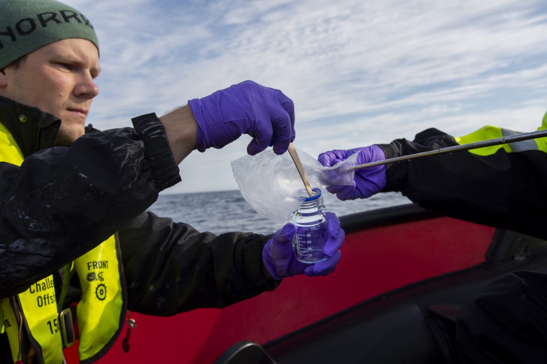
    Text: Frances Cooke (PhD Candidate in the Gas Hydrates and Free Gas Reservoirs research group at CAGE, working within the SEAMSTRESS project).


    We continued shooting seismic for the active survey experiment. Some inlines were dropped, to make up time so that we would be ready by 16:00 to start the circular lines. The weather conditions remain perfect for seismic, the sea is calm and there is a moderate breeze.

    One thing is certain while working at sea; you can never be too confident that things will go to plan! We had planned to recover the OBS tomorrow morning after completion of the seismic lines, however a large number of whales showed up within 500m of the ship. As there were so many whales showing up so close to the vessel, we shut down all our acoustic systems, including the seismic guns. On the bridge they saw plenty of finwhales and Knølhval (horn whale) breaching the surface. The ‘Havforskningsinstitutet’ (Institue for marine research) specify that the Greenland whale and Narwals are species that require the most protection.

    The mini GI air guns we use for the seismic are 15 and 30 cu.in. The guns are significantly smaller than conventional seismic guns used in industry. Higher powered guns are used to send signals much deeper into the subsurface. We are only interested in high detail in the near surface sediments (top ~300m).

    While on the bridge deck looking out in awe, we spoke about how long we should wait before starting the seismic back up. This depends on the water depth. Whales spend up to 45 minutes beneath the surface in deep (+1000m) water, so we could be waiting an hour before knowing whether the whales are still close by. I worked on a seismic vessel where we had a marine mammal observer onboard. However, she would not observe the whales. Instead, with her own hydrophone, would spend the whole shift with headphones on, listening for whale calls. Relaxing shift?

    As time is precious, we decided to move away from the active seismic survey site and move south to Svyatogor ridge to complete some seismic lines for our colleagues not on the cruise – in whale free areas.

    Whales as far as the eye can see. (photo: Vera Schlindwein)


    Read more about the SEAMSTRESS project here.

  • Arrived to new survey site

    Arrived to new survey site

    Cruise Blog by Frances Cooke: Day 9

    July 15th, 2021

    Text and photos: Frances Cooke (PhD Candidate in the Gas Hydrates and Free Gas Reservoirs research group at CAGE, working within the SEAMSTRESS project).

    We arrived to our new active seismic survey location yesterday late afternoon and started with chirp survey lines closely spaced over a previously interpreted mud diapir and buried glacial meltwater flow. The chirp is also seismic data and classed as ‘single channel.’ It uses a hydrophone array mounted on the hull of the ship, and the transmitted sound is just a ‘ping’ or ‘chirp,’ as opposed to ‘multi-channel’ hydrophones along a seismic streamer, that require a small ‘bang’ from the guns. The frequency is much higher; therefore, with this system we are able to image even finer (decimeter scale) sediment layering near the surface. The chirp typically penetrates ~40 m into the sediment in this area, however the chirp system on this ship penetrates just < 20 m, so we are missing some data deeper down.

    3D surface in miliseconds two-way time, using a rainbow colour scale, extracted from 3D seismic volume data, shows a buried glacial feature. The purple line is one of the chirp survey lines that passes south of the feature. At the east of the line, we observe some hard glacial material transported by ice during the last glacial period.

    The profile of chirp line 3 shows the buried glacial debris – a hard surface, potentially supersaturated with water or gas.


    This morning 5 OBS were deployed for the active experiment. Two belong to UiT and have a short period frequency range for detecting shallow earthquakes and the remaining three are broadband OBS from AWI that also have long period signals that range deeper.  The OBS team had a rocky start deploying the instruments, with the first OBS bashing into the side of the ship, and needed some repairs.

    Bathymetry map (topography of the seafloor) showing an overview of the work completed in the cruise so far and our ongoing active seismic survey, in the new east location, with Prins Karls Forland in site.


    After completing the chirp survey lines and deploying the OBS, we put out the seismic today at 12.15. We will shoot all 12 crosslines and some ‘inlines’ first, then we will move onto the circlular lines. The acquisition survey design is typically in this way for OBS active experiments, with the feature of interest in the centre of the array. The placement of the OBS is also dependent on the topography of the seafloor. We try to avoid landing them on dipping surfaces and away from depressions. We have begun with the crosslines (NE-SW), and by tomorrow we should have come to the end of the in lines (NW-SE).  The wind has finally dropped and the sea is calm – for now!


    Active OBS experiment seismic array (black lines) and chirp survey lines in gray.


    Read more about the SEAMSTRESS project here.

  • Working around the sea ice

    Working around the sea ice

    Cruise Blog by Frances Cooke: Day 8

    July 14th, 2021

    Text and photo: Frances Cooke (PhD Candidate in the Gas Hydrates and Free Gas Reservoirs research group at CAGE, working within the SEAMSTRESS project).

    The fog cleared during the night while the OBS team were in bed, and the sun shone briefly. We continued the multibeam survey, started two days ago, all through the night, until breakfast. We had an English breakfast this morning, eggs and bacon, but no beans. The final OBS was recovered mid-morning and OBS preparation for the active seismic experiment has started.

    If it’s not the strong wind or the fog preventing OBS work – it’s the sea ice! We planned a seismic experiment before the start of the cruise, in the west of Vestnesa ridge. Here we will most likely encounter sea ice. We discover today that our proposed location for the OBS sits within the open drift ice. It would be foolish to take the risk and deploy the OBS, while the charts show drift ice nearby. I am told that deploying the OBS in sea ice is no problem, but when the OBS surfaces it could get stuck beneath the ice.

    The  Norwegian Meteorological Institute (www.cryo.met.no) provides ice charts and satellite images daily that we can use to monitor the whereabouts and movement of sea ice. The satellite imagery is not affected by cloud cover and can acquire data during the day or night and under all weather conditions.

    An ice chart overlaid onto the bathymetry (seafloor map) provides location of drift ice in the Fram Strait. The active seismic planned experiment in the west of Vestnesa ridge is within open ice drift.

    The latest satellite image used for mapping of the sea ice (cryo.met.no). The sentinel-1 mission includes a C-band Synthetic Aperture Radar (SAR) sensor that has a resolution down to 5m. Red arrow points to west Vestnesa ridge.

    The winds were high in the afternoon, so we continued with multibeam mapping, extending away from our first survey area towards the northwest. Once the ship met the sea ice we decided to abort the multibeam survey, change course and head three hours east to prepare ourselves for the active OBS deployment in an ice free conditions.


    For the transit there were fresh wienebrød (Norwegian custard centered pastries). De var gode!


    Birds pictured on the sea ice, during the last multibeam survey line, heading northwest, towards the western part of Vestnesa ridge.


    Read more about the SEAMSTRESS project here.

  • Poor visibility and successful OBS recoveries

    Poor visibility and successful OBS recoveries

    Cruise Blog by Frances Cooke: Day 7

    July 13th, 2021

    Text and photo: Frances Cooke (PhD Candidate in the Gas Hydrates and Free Gas Reservoirs research group at CAGE, working within the SEAMSTRESS project).

    If it’s not a strong wind preventing the recovery of the OBS it’s poor visibility. We stopped the recovery of the OBS late in the night due to fog, and deployed the seismic in the early hours, ready to go at 01:30. We repeated a seismic line that was shot in bad weather from the day before. This time the line started with fairly low winds (9m/s) and then the wind picked back up midway through. When the line was completed, we had to recover the seismic to transit to the start of the next line. It is a lot of work taking the seismic equipment in and out, but we are unable to transit between lines at a good speed with the equipment in the water. Time is everything when working at sea.

    We (the night shift) were let off bringing the seismic back in for the second time in the night. The day shift took over and completed the second seismic line of the day (Line 5). We managed to recover two OBS before lunch, and another at 16:00. All the OBS recoveries went smoothly, and we were joined by a pod of dolphins at 17:40 during OBS # 3 and large number of puffins, in flight circling around the ship. They are the fastest flying birds I have ever seen at sea. They don’t appear to conserve any energy while flying. They look like they are going somewhere in a hurry, and it is almost impossible (using my compact camera) to get a good picture of them.

    It took a little longer than usual to spot OBS # 3. Conditions never seem to be completely perfect for the job! This time the glare on the water made spotting the OBS difficult. Przemek was the only one wearing sunglasses, and was able to strain his eyes to spot the OBS some 300-400 metres away from the ship. What made it even more difficult to spot was that the flag was lying flat against the water, instead of upright.

    Between OBS sites 3 and 9 we transited for an hour. This was a good opportunity to eat the freshly prepared doughnuts left in the mess. What a treat!

    We successfully recovered OBS # 9, and there were hopes to recover the last OBS left on the sea floor, but the fog returned. The day shift OBS team, were exhausted after such a successful day of OBS recoveries and went straight to bed.

    Andreia watches out for the (not so obvious) OBS near the ship.


    The view of the OBS drifting by, moments before catching it, using a hook thrown out to the line to pull it in.


    Mechita and Andreia assist with the winch operation as the OBS lifts out of the water.


    Read more about the SEAMSTRESS project here.

  • Back to site

    Back to site

    Cruise Blog by Frances Cooke: Day 6

    July 12th, 2021

    Text and photo: Frances Cooke (PhD Candidate in the Gas Hydrates and Free Gas Reservoirs research group at CAGE, working within the SEAMSTRESS project).

    Back to site

    We arrived back to site at 02:30 and the weather was less than ideal for seismic. We are limited with what we can do in poor weather, but waiting doing nothing is not a favourable option. We deployed the seismic in a slightly uncomfortable but a ‘safe to deploy’ sea state (winds 12-13 m/s). We started the deployment of the equipment at 04:00 then transited to the start of the survey line starting at 05:30. The line was complete at 08:30 just after our fantastic breakfast of pancake topped with berry jam and maple syrup.

    The day shift (Vera, Mechita and Przemek) were up earlier than usual at 06:00, as the plan was to start the recovery of the OBS, but as it was too windy they had to wait until later on in the day. We decided the next best thing was to start a small multibeam survey. We plan to use the multibeam map to compare with the same data acquired in previous years, to see if there is any slump movement recorded in the sediments (pictured). We completed three lines of multibeam before cutting the fourth line short to recover OBS #5, and #6 once we had entered a calmer sea state.

    Map of the bathymetry (seafloor topography) in the rainbow coloured depth scale, acquired during the small multibeam survey. Orange filled circles are the locations of OBS #5 and #6.

    Recovering OBS #5

    I hear Vera on the radio at 20:45 “OBS is rising. It’s at 730 metres” so I go up to the bridge to get ready with Truls and Hans (the Captain) to look for the OBS. Outside on the bridge deck are Andreia, Przemek and Mechita ready and waiting for the OBS to come to the surface. Attached to the side of the OBS is a flashing light and radio beacon that sends out a signal in one of four different frequencies, assigned to each OBS. The radio picks up the signal and makes a beeping sound when the OBS is close and Przemek and Mechita are then able to find the direction of the signal in relation to where they are standing on the ship. As the signal can only be picked up close to the ship, relying on sight is sometimes more reliable, so the more eyes on watch the better!

    Andreia and Przemek holding the radio, looking and listening for the OBS once Vera has confirmed that it has reached the surface.


    Read more about the SEAMSTRESS project here.

  • A quick stop in Longyearbyen

    A quick stop in Longyearbyen

    Cruise Blog by Frances Cooke: Day 5

    July 11th, 2021

    Text and photo: Frances Cooke (PhD Candidate in the Gas Hydrates and Free Gas Reservoirs research group at CAGE, working within the SEAMSTRESS project).


    We arrived into Longyearbyen 05:50 on what was a very pleasant morning. We tied up to the wharf in view of the seed vault and joining us were three adult common eider ducks (ærfugl) and their 21 ducklings, together with two adult barnacle geese (Hvitkinngås in Norwegian – ‘white cheek goose’). I had initially thought that the eider ducks were pink-footed geese, until Stormer corrected me. He told me a story about an ærfugl he found on the aft of the Kronprins Håkon. On a cold, stormy November day while on the way to Greenland, Stormer moved a stack of pallets to prepare for coring, and there standing before him was a duck. The duck was standing so still, the first thought that came to mind was “who brings a wooden duck onboard?” He took a step forward to take a closer look, to find that the duck was in fact a real duck. An ærfugl. The crew kept her warm and fed, and released her back into the wild in Tromsø.


    Two barnacle geese, three common eider ducks and their 21 ducklings

    It was a quick turnaround, and we left Longyearbyen at 15:00 after our new crew member joined the ship. The plan is to deploy the seismic at 03:00 on our return back to site, however plans can quickly change and the order of activities is dependent on the weather forecast. We left behind bright skies in Longyearbyen, with a striking display of cirrus and cirrocumulus clouds. After eating match-worthy food – chili and nachos, and watching the intense euros finals game, we wait three more hours and hope that the waves will calm for the seismic deployment.


    Prins Karls Forland in the distance with magnificent cloud formations – originally named Prince Charles’ Foreland after King James’ son in 1612.


    Read more about the SEAMSTRESS project here.

  • Successful OBS recovery

    Successful OBS recovery

    Cruise Blog by Frances Cooke: Day 4

    July 10th, 2021

    Text and photo: Frances Cooke (PhD Candidate in the Gas Hydrates and Free Gas Reservoirs research group at CAGE, working within the SEAMSTRESS project).


    While the night shift took some rest, we successfully recovered one OBS (no. 10) at the northern termination of Knipovich ridge (NKR). The original plan was to recover two OBS but the visibility was too poor. The breaking waves made the search for the OBS a difficult task!


    Clock Drift

    ‘DIRC’ Clocks in the OBS are temperature sensitive. When the clocks are recovered they need to be synchronized right away before they warm. They are synchronized at the beginning (pre-deployment) and at the end (on recovery). It is known that during the experiment the clocks drift linearly. This clock error is applied automatically which addresses the linear drift problem. However, there is also non linear drift which is a much more time consuming fix (requiring several weeks of processing). Vera tells me that the new manufactured (AWI) seismometers were fitted with clocks that have worse drift than the old seismometer clocks. They are less power consuming but the processing as a result is more time consuming!

    The seismic deployment began at midnight, and we were ready to start our first 2D seismic line by 01:30 AM. During the night shift we will complete at least 2 survey lines that will take approximately 3 hours each to shoot (line distances: ~25 km). The sea feels a little rough (2m swell), but by tomorrow evening the wind will drop.

    Bathymetry map displaying NKR survey area with seismic lines and OBS pick up locations (orange), the red cross marks the retrieved OBS no. 10 (recovered late in the evening on day 3)


    We completed four seismic lines, finishing the last line just after 18:00. We had to stop work and recover the seismic instrumentation after an incident onboard required a helicopter rescue. We had planned to start OBS recovery at midnight during the calm weather, but now we will head to Longyearbyen and wait for a replacement crewmember to join us.


    A very impressive and quick helicopter rescue operation


    Read more about the SEAMSTRESS project here.

  • The unpredictability factor during a cruise

    The unpredictability factor during a cruise

    July 9th, 2021

    Text and photo: Andreia Plaza-Faverola, chief scientist SEAMSTRESS/CAGE cruise.


    We have been waiting for an ideal weather window to collect the OBSs. Once released from an iron frame that keeps it at the bottom, the OBS starts rising through the water column at about 1 m/s. When it makes it to the surface it is good to have visibility and no waves, so it is easy to see it. We dared to get one under relatively strong winds and it was a bit of a stress to find it – the wind creates superficial waves where the OBS can hide. The crew found it from the bridge using the binoculars. There was a significant drift and we saw it several hundreds of meters north from the ship. It felt like a big relief when Jan came out to tell they had it on site. They fished it fairly easy and the data looks great.


    Our first Ocean Bottom Seismic recorder (OBS) is on deck – it is called the “Lobster”. This is one of 5 OBSs we have at the Department of Geosciences at UiT. The little flying-saucer hanging from a flag pole is the seismometer that records both, compressional and shear waves that propagate through the ocean floor. A hydrophone (that only records waves that propagate through the water) is placed over the floating frame (orange cylinders), next to the devise that releases the instrument from the iron weight so it can come back to the surface. 


    We decided to keep waiting for the wind to ease down. We started then with the seismic lines. We collected 4 lines and we were ready to continue with the recovery of OBSs when the Captain informed that we needed to sail to Longyearbyen because our machinery guy injured his hand. A helicopter picked him up and that was quit an impressive operation. Helmer Hanssen doesn’t have a heliport so the helicopter stays in the air while a rescuer descends with a rope to get the injured person from the front deck of the ship – incredibly professional and impressive operation. Feeling respectful of those with that metier…

    A roundtrip to Longyearbyen and back after having a replacement “makinist” on-board will take us around 22 hours. Now we are leaving the pretty mountains of Svalbard in the background under a wiggly sky. Tonight we expect to continue with seismics and tomorrow early get on track with the recovery of the OBSs.

    But who knows what will happen, there is always that factor that makes our research cruises in the Arctic, unpredictable…

    The Mountains of Marineholmane stays in the background with a funny sky


    Read more about the SEAMSTRESS project here.

  • Instrument preparations are underway

    Instrument preparations are underway

    Cruise Blog by Frances Cooke: Day 2

    July 8th, 2021

    Text and photo: Frances Cooke (PhD Candidate in the Gas Hydrates and Free Gas Reservoirs research group at CAGE, working within the SEAMSTRESS project).

    Preparing the instrumentation

    Temperatures have dropped and the skies are grey. The bathymetry (map of the seafloor) shows a typical Barents Sea display of iceberg ploughmarks cut deeply into the seafloor as we cross over the ‘Polar Sonen’ – a blue line displayed on the ship’s navigational map extending from Russia through to Iceland. We are still 1 day and 14 hours away from our OBS recovery site, but we have some tests to do along the way.

    Barents Sea real time bathymetry swath with iceberg scours (yellow)

    Preparation: OBS releasers

    We are preparing our OBS releasers for testing at ~1250m water depth, away from the shallow Barents Sea continental shelf. It is important to test the instruments at the same water depth as the OBS site to ensure a comparable pressure. The releasers are the most important part of the OBS to test. If they do not function correctly, the OBS will fail to return to the surface. They are called back using an acoustic device that sends a command through the water to the instrument instructing its release. We will lower the cage with all six releasers (1 from CAGE (Seamstress) and 5 from AWI) and we will talk to them and wait to see if they talk back. Bergen University were lucky this year to recover their ‘lost’ OBS picked up during the AKMA CAGE cruise in May using a remotely operated vehicle.

    The OBS releaser cage with two releasers inside (4 more left to prepare)

    Top left: all releasers ready to be deployed (in view Kathi, Kunigunde and Kordula). Emma, Diana, Christine and Wojtek – the easily identifiable instrumentation from the Alfred Wegener Institute.

    OBS naming

    Five of the releasers have names: Kunigunde, Kathi, Kordula, Kaya and Kim. Vera and Machita inform us that all the parts that make up the OBS (hydrophones, frames, beacon, releaser etc.) have names. The names made for the releasers start with a letter K or L. In the labs at AWI, they have in total ~1000 pieces of equipment to manage, including auxillary parts such as laptops, deck units, and cables. They have 80 OBS equipment groups. Each OBS group is comprised of 10 parts. The serial numbers are so similar that naming the equipment makes it much easier to identify them. I ask how they manage to find names for 800+ OBS parts, and they reply that the names are both male and female, and both German and foreign.  The names are also old fashioned such as Kunigunde. Watching the Denmark-England game last night was possibly as intense as the half hour wait time during the recovery of the OBS – at least for some. Others discussed the names of the players:  Boleslaw – an old-fashioned Polish name. A good reserve name for a Beacon.

    Top: The deployment of the releasers cage, bottom: Przymek, Vera and Mechita watching the winch wire go out, waiting for the cage to drop down to 1250m before communication with the releasers begins.

    While Vera, Mechita and Przymek were preparing the OBS releasers, Truls and Stormer were preparing UiT’s two ‘Digi-birds.’ This is equipment used to control the depth of the cable in the water for seismic operations. The birds are mounted externally on a marine seismic streamer cable. They have acoustic devices that measure actual depth of the cable during operation, through an onboard sensor located in the wing module. Periodic adjustments are made to the angle of the birds wings (or “fins”) to drive the bird (and streamer) back towards the target depth.

    Top: Truls and Stormer fix the wings to the birds; bottom: Truls and Stormer attach one of the birds to the streamer cable on deck.


    Read more about the SEAMSTRESS project here.

  • Transit to Vestnesa Ridge – West Svalbard

    Transit to Vestnesa Ridge – West Svalbard

    Cruise Blog by Frances Cooke: Day 1

    July 7th, 2021

    Text and photo: Frances Cooke (PhD Candidate in the Gas Hydrates and Free Gas Reservoirs research group at CAGE, working within the SEAMSTRESS project).

    Day 1:

    We departed Tromsø on the Helmer Hanssen before our first, of likely many, onboard fish lunches. We were glad of the sea breeze after the unusual Arctic summer heat during the past few days. The seas are calm which is always a relief knowing that your journey north is going to be a smooth one and we found the server machine room the perfect place to cool down! We are in transit returning to Vestnesa Ridge – West Svalbard to recover earthquake data from previously deployed ocean-bottom seismic instruments (OBS). OBS are instruments that contain seismometers and hydrophones that sit on the seafloor, listening and recording vibrations from shallow earthquakes.

    Last view of the land: Vannøya

    Onboard we have two of our colleagues from the Alfred Wegener Institute (Vera and Mechita), three from the Seamstress project (Andreia, Frances and Przemek) and two technical engineers (Stormer and Truls). We are busy setting up the GPS required for the active OBS experiment that will take place at the west of Vestnesa ridge. We have Sunil (in-house expert) present through video call while we are near shore! The setup ensures that we have precision in the timing and positioning of each shot fired during the active experiment.

    Figures for planning of the active source experiment. The green filled circles (right) are 8 OBS deployment locations. The survey lines and circles are for the seismic planning.

    Stormer and Andreia attach GPS antenna to railing

    Last year during cruise CAGE20_5 we recovered 7 OBS as part of the Seamstress passive seismic experiment. This experiment took place between July 2019 and August 2020. The OBS instruments in the passive experiment record signals generated by earthquakes or other natural sound waves such as whale calls, instead of being actively generated by airguns. During the same cruise, we deployed 10 more OBS to begin a new experiment at the northern termination of the Knipovich mid-ocean ridge. We are now on our way back to recover them.

    Figure from CAGE20_5 cruise report. Pink triangles are the OBS we are on our way to collect (North of the Knipovich mid ocean ridge – West Svalbard)


    Read more about the SEAMSTRESS project here.

  • A new cruise season starts – what will the Ocean Bottom Seismometers we left last year tell us?

    A new cruise season starts – what will the Ocean Bottom Seismometers we left last year tell us?

    We are looking forward to get the Ocean Bottom Seismometers (OBS) up and see whether they have something interesting to reveal about the movement of the earth and the methane down there in the deep ocean.

    Text and photo: Andreia Plaza-Faverola, chief scientist SEAMSTRESS/CAGE cruise.

    July 7th, 2021

    Planning a cruise this year has obviously not been easy – why should have it? We are all across the planet leaving a difficult time.

    But here we are, we got onboard for a 15 days research cruise with the main objective of recovering the OBSs that we deployed last year (see previous posts). We are a compact scientific crew this year: Przemek, Frances, Vera, Mechita and Andreia, with support from our engineers Truls and Stormer (nothing to complain about the gender balance). For the first time in many years I am coming to an OBS/seismic cruise without Stefan and Sunil and the possibility of not managing to get a code or a program running makes me anxious. 🙂

    We left Tromsø in calm waters with a suffocating temperature of nearly 30 C. Now we are back to Arctic temperatures…We have used the transit to set and test software and equipment. Tomorrow we will be on site by 18:00 to pick up the first (southernmost) OBS from 10 we have in the water at the northern termination of the Knipovich Ridge.

    Just a few minutes ago they called us from the bridge to see a bunch of Fin whales and dolphins playing together very close from the ship. The perfect spectacle to continue the transit.

    Photo: Sailing in the fjords on R/V Helmer Hanssen, in a calm sea at 30 C


    Read more about the SEAMSTRESS project here.

  • Award for best MSc thesis at Faculty of Science and Technology 2020

    Award for best MSc thesis at Faculty of Science and Technology 2020

    We would like to wish a big congratulations to WP1 Ph.D candidate  Cornelia Mentzoni Binde, for receiving the award for the best M.Sc. thesis at the Faculty of Science and Technology 2020, as well as congratulations to MSc supervisors Professor Stefan Bünz and Dr Sunil Vadakkepuliyambatta!
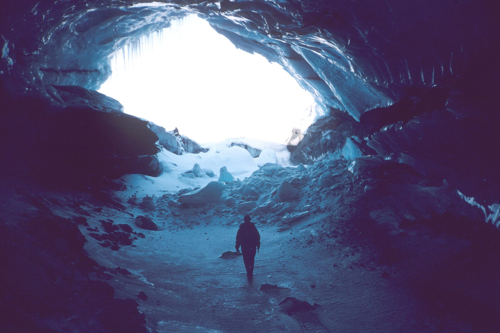
  • A new frontier in climate change science: connections between ice sheets, carbon and food webs

    A new frontier in climate change science: connections between ice sheets, carbon and food webs

    “We are sleepwalking into a catastrophe for humanity. We need to take notice right now. It is already happening. This is not a wait-and-see situation anymore.” says Professor Jemma Wadham. She has recently published “Ice Rivers” a fascinating story about the state of the glaciers in a warming climate, and a personal memoir.

    Text: Maja Sojtaric

    (more…)

  • Methane nibbling bacteria are more active during summer

    Methane nibbling bacteria are more active during summer

    Bacteria that thrive on methane released from the ocean floor are an important barrier preventing the greenhouse gas from reaching the atmosphere. A new study finds that these microbial communities flourish in seabed depressions and are more effective during the summer.

    Text: Maja Sojtaric/Mariana Esteves

    (more…)

  • Methane release rapidly increases in the wake of the melting ice sheets

    Methane release rapidly increases in the wake of the melting ice sheets

    Melting of the Arctic ice sheets caused rapid methane release from the ocean floor during the last two deglaciations, according to a new study in Geology. A similar release is likely to happen today, and should be included in climate models, say the scientists.

    Text: Maja Sojtaric/GSA

    (more…)

  • Snow chaos in Europe caused by melting sea-ice in the Arctic

    Snow chaos in Europe caused by melting sea-ice in the Arctic

    The April snow falling on fruit blossoms in Europe these days may be directly connected to the loss of the sea ice in the Barents Sea in the Arctic. That was certainly the case in 2018 when the sudden cold spell known as “Beast from the East” descended on the mid-latitudes of the continent,  a new study in Nature Geoscience shows.

    Text: Maja Sojtaric

    (more…)

  • Methane monitoring project receives 23,5 million NOK in funding

    Methane monitoring project receives 23,5 million NOK in funding

    EMAN 7 project aims to understand the environmental impact of methane seepage from the sea floor in Lofoten-Vesterålen area in Norway. Methane seepage can cause ocean acidification, which in turn may threaten the ecosystem.

    Text: Maja Sojtaric

    (more…)

  • Rapid ice retreat during last deglaciation parallels current melt rates

    Rapid ice retreat during last deglaciation parallels current melt rates

    Imagine an ice chunk the size of Hawaii disappearing, almost instantaneously, from an ice sheet. That is what happened in the Storfjorden Through in the Arctic Ocean some 11,000 years ago.

    Text: Maja Sojtaric

    (more…)